Brennberg geodata
Brennberg (Bavaria) is a seat of a fourth-order administrative division; located in Germany in Europe/Berlin (GMT+2) time zone. With population of 1,834 people, there are 5293 cities with bigger population in this country. Compared to other cities in Germany, 82.2% of cities are located further ↑North; 87% of cities are located further ←West and 92.7% of cities have lower elevation than Brennberg. Note1
Administrative division(s):
- Level 1: Bavaria
- Level 2: Upper Palatinate
- Level 3: Landkreis Regensburg
- Level 4: Brennberg


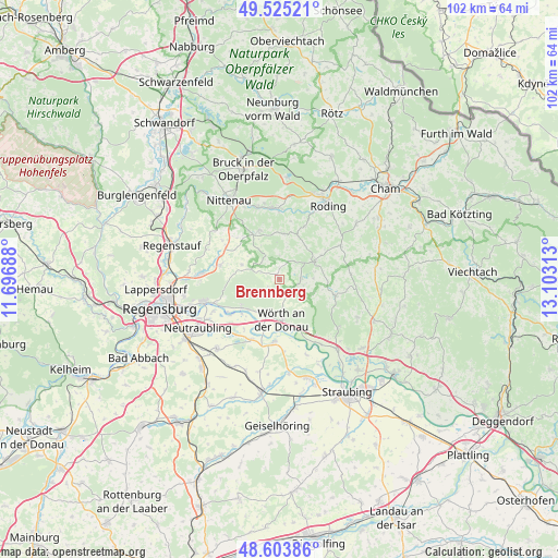
Brennberg GPS coordinates[2]
49° 4' 0.012" North, 12° 24' 0" East
| Map corner | latitude | longitude |
|---|---|---|
| Upper-left | 49.52521°, | 11.69688° |
| Center: | 49.06667°, | 12.4° |
| Lower-right: | 48.60386°, | 13.10313° |
| Map W x H: | 102.4×102.4 km | = 63.6×63.6mi |
| max Lat: | 55.01917° ⇑82.2% North |
| Brennberg: | 49.06667° |
| min Lat: | ⇓17.8% South 47.40724° |
| min Long | Brennberg | max Long |
| 5.92978° | 12.4° | 14.98853° |
| W 87%⇐ | ⇒13% E |
Elevation
Elevation of Brennberg is 553 m = 1814 ft, and this is 303.9 m = 997 ft above average elevation for this country.
| Max E: |
1256 m = 4121 ft | 7.3% |
| Brennberg | 553 m 1814 ft | |
| Avg. | 249.1 m = 817 ft | |
Min E: |
-5 m = -16 ft | 92.7% |
See also: Germany elevation on elevation.city.
Geographical zone
Brennberg is located in North temperate zone (between Tropic of Cancer and the Arctic Circle). Distance of this North polar circle is 1945.5 km =1208.9 mi to North.| Distance of | km | miles | from Brennberg |
|---|---|---|---|
| North Pole | 4551.4 | 2828.1 | to North |
| Arctic Circle | 1945.5 | 1208.9 | to North |
| Tropic Cancer | 2849.8 | 1770.8 | to South |
| Equator | 5455.7 | 3390 | to South |


Nearby cities:
15 places around Brennberg: (largest is in red/bold)
• Aholfing
14.6 km =9.1 mi,  160°
160°
• Altenthann
8.2 km =5.1 mi,  296°
296°
• Bernhardswald
11.4 km =7.1 mi,  283°
283°
• Falkenstein
7.3 km =4.5 mi,  61°
61°
• Michelsneukirchen
12.8 km =8 mi, 60°
• Pfatter
11.6 km =7.2 mi,  186°
186°
• Reichenbach
13.5 km =8.4 mi,  344°
344°
• Rettenbach
3.6 km =2.2 mi,  90°
90°
• Tiefenbach
14.3 km =8.9 mi, 337°
• Wald
10 km =6.2 mi, 338°
• Walderbach
13 km =8.1 mi,  354°
354°
• Wenzenbach
14.6 km =9.1 mi,  273°
273°
• Wiesenfelden
10.6 km =6.6 mi,  105°
105°
• Wiesent
5.7 km =3.5 mi, 192°
• Wörth an der Donau
7.3 km =4.5 mi,  176°
176°
Sources, notices
• [Note1] Compared only with cities in Germany existing in our database
• [Src1] Map data: © OpenStreetMap contributors (CC-BY-SA)
• [Src2] Other city data from geonames.org with taken over terms of usage.
• [Src3] Geographical zone / Annual Mean Temperature by Robert A. Rohde @ Wikipedia
