Berlingerode geodata
Berlingerode (Thuringia) is a seat of a fourth-order administrative division; located in Germany in Europe/Berlin (GMT+2) time zone. With population of 1,248 people, there are 6454 cities with bigger population in this country. Compared to other cities in Germany, 65.7% of cities are located further ↓South; 54.1% of cities are located further ←West and 50.1% of cities have lower elevation than Berlingerode. Note1


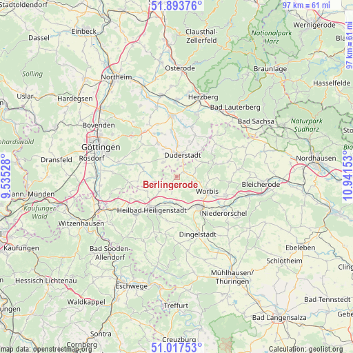
Berlingerode GPS coordinates[2]
51° 27' 27.9" North, 10° 14' 18.24" East
| Map corner | latitude | longitude |
|---|---|---|
| Upper-left | 51.89376°, | 9.53528° |
| Center: | 51.45775°, | 10.2384° |
| Lower-right: | 51.01753°, | 10.94153° |
| Map W x H: | 97.4×97.4 km | = 60.5×60.5mi |
| max Lat: | 55.01917° ⇑34.3% North |
| Berlingerode: | 51.45775° |
| min Lat: | ⇓65.7% South 47.40724° |
| min Long | Berlingerode | max Long |
| 5.92978° | 10.2384° | 14.98853° |
| W 54.1%⇐ | ⇒45.9% E |
Elevation
Elevation of Berlingerode is 226 m = 741 ft, and this is 23.1 m = 76 ft below average elevation for this country.
| Max E: |
1256 m = 4121 ft | 49.9% |
| Avg. | 249.1 m = 817 ft | |
| Berlingerode | 226 m = 741 ft | |
Min E: |
-5 m = -16 ft | 50.1% |
See also: Germany elevation on elevation.city.
Geographical zone
Berlingerode is located in North temperate zone (between Tropic of Cancer and the Arctic Circle). Distance of this North polar circle is 1679.6 km =1043.7 mi to North.| Distance of | km | miles | from Berlingerode |
|---|---|---|---|
| North Pole | 4285.5 | 2662.9 | to North |
| Arctic Circle | 1679.6 | 1043.7 | to North |
| Tropic Cancer | 3115.6 | 1935.9 | to South |
| Equator | 5721.6 | 3555.2 | to South |


Nearby cities:
15 places around Berlingerode: (largest is in red/bold)
• Brehme
9.3 km =5.8 mi,  64°
64°
• Duderstadt
6.3 km =3.9 mi,  13°
13°
• Ecklingerode
7.2 km =4.5 mi,  49°
49°
• Ferna
4.4 km =2.7 mi,  101°
101°
• Glasehausen
6.2 km =3.9 mi,  253°
253°
• Hundeshagen
4.1 km =2.5 mi,  131°
131°
• Reinholterode
5 km =3.1 mi,  217°
217°
• Siemerode
9 km =5.6 mi,  244°
244°
• Steinbach
4.2 km =2.6 mi,  199°
199°
• Tastungen
5.1 km =3.2 mi,  75°
75°
• Teistungen
2.2 km =1.4 mi, 63°
• Wehnde
6.1 km =3.8 mi, 62°
• Wingerode
7.5 km =4.7 mi,  179°
179°
• Wintzingerode
6.8 km =4.2 mi, 103°
• Worbis
9.6 km =6 mi,  115°
115°
Sources, notices
• [Note1] Compared only with cities in Germany existing in our database
• [Src1] Map data: © OpenStreetMap contributors (CC-BY-SA)
• [Src2] Other city data from geonames.org with taken over terms of usage.
• [Src3] Geographical zone / Annual Mean Temperature by Robert A. Rohde @ Wikipedia
