Steinbach geodata
Steinbach (Thuringia) is a seat of a fourth-order administrative division; located in Germany in Europe/Berlin (GMT+2) time zone. With population of 563 people, there are 9012 cities with bigger population in this country. Compared to other cities in Germany, 65.2% of cities are located further ↓South; 53.7% of cities are located further ←West and 69.5% of cities have lower elevation than Steinbach. Note1


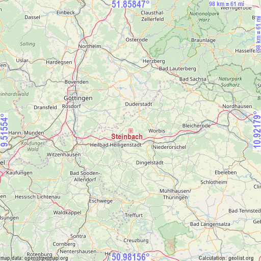
Steinbach GPS coordinates[2]
51° 25' 19.632" North, 10° 13' 7.176" East
| Map corner | latitude | longitude |
|---|---|---|
| Upper-left | 51.85847°, | 9.51554° |
| Center: | 51.42212°, | 10.21866° |
| Lower-right: | 50.98156°, | 10.92179° |
| Map W x H: | 97.5×97.5 km | = 60.6×60.6mi |
| max Lat: | 55.01917° ⇑34.8% North |
| Steinbach: | 51.42212° |
| min Lat: | ⇓65.2% South 47.40724° |
| min Long | Steinbach | max Long |
| 5.92978° | 10.21866° | 14.98853° |
| W 53.7%⇐ | ⇒46.3% E |
Elevation
Elevation of Steinbach is 355 m = 1165 ft, and this is 105.9 m = 347 ft above average elevation for this country.
| Max E: |
1256 m = 4121 ft | 30.5% |
| Steinbach | 355 m 1165 ft | |
| Avg. | 249.1 m = 817 ft | |
Min E: |
-5 m = -16 ft | 69.5% |
See also: Germany elevation on elevation.city.
Geographical zone
Steinbach is located in North temperate zone (between Tropic of Cancer and the Arctic Circle). Distance of this North polar circle is 1683.6 km =1046.1 mi to North.| Distance of | km | miles | from Steinbach |
|---|---|---|---|
| North Pole | 4289.5 | 2665.4 | to North |
| Arctic Circle | 1683.6 | 1046.1 | to North |
| Tropic Cancer | 3111.7 | 1933.5 | to South |
| Equator | 5717.6 | 3552.8 | to South |


Nearby cities:
15 places around Steinbach: (largest is in red/bold)
• Berlingerode
4.2 km =2.6 mi,  19°
19°
• Ferna
6.4 km =4 mi,  61°
61°
• Geisleden
8.1 km =5 mi,  189°
189°
• Glasehausen
5.1 km =3.2 mi,  295°
295°
• Heilbad Heiligenstadt
7.5 km =4.7 mi,  229°
229°
• Hundeshagen
4.7 km =2.9 mi,  74°
74°
• Kreuzebra
8.3 km =5.2 mi,  164°
164°
• Leinefelde-Worbis
8.4 km =5.2 mi,  116°
116°
• Reinholterode
1.7 km =1.1 mi,  269°
269°
• Siemerode
6.8 km =4.2 mi, 270°
• Tastungen
8.2 km =5.1 mi,  50°
50°
• Teistungen
6 km =3.7 mi,  33°
33°
• Wehnde
9.6 km =6 mi,  44°
44°
• Wingerode
3.8 km =2.4 mi, 157°
• Wintzingerode
8.4 km =5.2 mi, 73°
Sources, notices
• [Note1] Compared only with cities in Germany existing in our database
• [Src1] Map data: © OpenStreetMap contributors (CC-BY-SA)
• [Src2] Other city data from geonames.org with taken over terms of usage.
• [Src3] Geographical zone / Annual Mean Temperature by Robert A. Rohde @ Wikipedia
