Bergisch Gladbach geodata
Bergisch Gladbach (North Rhine-Westphalia) is a seat of a third-order administrative division; located in Germany in Europe/Berlin (GMT+2) time zone. With population of 106,184 people, there are 90 cities with bigger population in this country. Compared to other cities in Germany, 57.9% of cities are located further ↓South; 92.1% of cities are located further →East and 68.8% of cities have higher elevation than Bergisch Gladbach. Note1
Administrative division(s):
- Level 1: North Rhine-Westphalia
- Level 2: Regierungsbezirk Köln
- Level 3: Rheinisch-Bergischer Kreis
- Level 4: Bergisch Gladbach


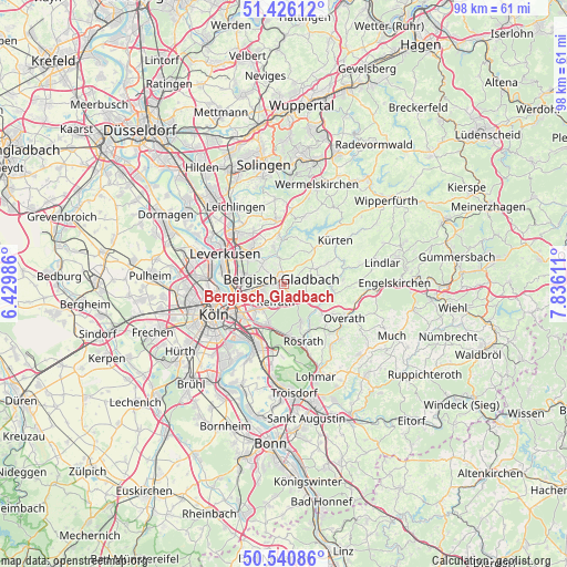
Bergisch Gladbach GPS coordinates[2]
50° 59' 8.16" North, 7° 7' 58.728" East
| Map corner | latitude | longitude |
|---|---|---|
| Upper-left | 51.42612°, | 6.42986° |
| Center: | 50.9856°, | 7.13298° |
| Lower-right: | 50.54086°, | 7.83611° |
| Map W x H: | 98.4×98.4 km | = 61.1×61.1mi |
| max Lat: | 55.01917° ⇑42.1% North |
| Bergisch Gladbach: | 50.9856° |
| min Lat: | ⇓57.9% South 47.40724° |
| min Long | Bergisch Gladba | max Long |
| 5.92978° | 7.13298° | 14.98853° |
| W 7.9%⇐ | ⇒92.1% E |
Elevation
Elevation of Bergisch Gladbach is 98 m = 322 ft, and this is 151.1 m = 496 ft below average elevation for this country.
| Max E: |
1256 m = 4121 ft | 68.8% |
| Avg. | 249.1 m = 817 ft | |
| Bergisch Gladbach | 98 m = 322 ft | |
Min E: |
-5 m = -16 ft | 31.2% |
See also: Bergisch Gladbach elevation on elevation.city.
Geographical zone
Bergisch Gladbach is located in North temperate zone (between Tropic of Cancer and the Arctic Circle). Distance of this North polar circle is 1732.1 km =1076.3 mi to North.| Distance of | km | miles | from Bergisch Gladbach |
|---|---|---|---|
| North Pole | 4338 | 2695.5 | to North |
| Arctic Circle | 1732.1 | 1076.3 | to North |
| Tropic Cancer | 3063.1 | 1903.3 | to South |
| Equator | 5669.1 | 3522.6 | to South |


Nearby cities:
15 places around Bergisch Gladbach: (largest is in red/bold)
• Buchforst
9.7 km =6 mi,  246°
246°
• Buchheim
8.7 km =5.4 mi,  244°
244°
• Burscheid
11.1 km =6.9 mi,  353°
353°
• Eil
10.9 km =6.8 mi,  200°
200°
• Gremberghoven
10.6 km =6.6 mi,  208°
208°
• Humboldtkolonie
11.4 km =7.1 mi, 238°
• Höhenberg
8.7 km =5.4 mi,  227°
227°
• Kalk
10.2 km =6.3 mi, 240°
• Leverkusen
11.5 km =7.1 mi,  295°
295°
• Mülheim
9.3 km =5.8 mi,  256°
256°
• Odenthal
5.4 km =3.4 mi, 347°
• Ostheim
8.7 km =5.4 mi, 225°
• Rath
7.4 km =4.6 mi, 202°
• Riehl
11.2 km =7 mi, 259°
• Rösrath
10.6 km =6.6 mi,  161°
161°
Sources, notices
• [Note1] Compared only with cities in Germany existing in our database
• [Src1] Map data: © OpenStreetMap contributors (CC-BY-SA)
• [Src2] Other city data from geonames.org with taken over terms of usage.
• [Src3] Geographical zone / Annual Mean Temperature by Robert A. Rohde @ Wikipedia
