Neustadt an der Waldnaab geodata
Neustadt an der Waldnaab (Bavaria) is a seat of a third-order administrative division; located in Germany in Europe/Berlin (GMT+2) time zone. With population of 6,153 people, there are 2413 cities with bigger population in this country. Compared to other cities in Germany, 70.6% of cities are located further ↑North; 84.3% of cities are located further ←West and 79.1% of cities have lower elevation than Neustadt an der Waldnaab. Note1
Administrative division(s):
- Level 1: Bavaria
- Level 2: Upper Palatinate
- Level 3: Landkreis Neustadt an der Waldnaab
- Level 4: Neustadt a.d.Waldnaab
Current local time in Neustadt an der Waldnaab:
02:41 AM, SaturdayDifference from your time zone: hours


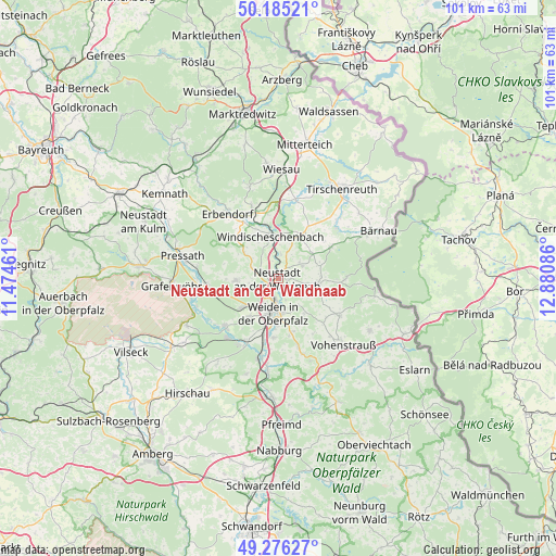
Neustadt an der Waldnaab GPS coordinates[2]
49° 43' 58.332" North, 12° 10' 39.828" East
| Map corner | latitude | longitude |
|---|---|---|
| Upper-left | 50.18521°, | 11.47461° |
| Center: | 49.73287°, | 12.17773° |
| Lower-right: | 49.27627°, | 12.88086° |
| Map W x H: | 101.1×101.1 km | = 62.8×62.8mi |
| max Lat: | 55.01917° ⇑70.6% North |
| Neustadt an der Waldnaab: | 49.73287° |
| min Lat: | ⇓29.4% South 47.40724° |
| min Long | Neustadt an der | max Long |
| 5.92978° | 12.17773° | 14.98853° |
| W 84.3%⇐ | ⇒15.7% E |
Elevation
Elevation of Neustadt an der Waldnaab is 428 m = 1404 ft, and this is 178.9 m = 587 ft above average elevation for this country.
| Max E: |
1256 m = 4121 ft | 20.9% |
| Neustadt an der Waldnaab | 428 m 1404 ft | |
| Avg. | 249.1 m = 817 ft | |
Min E: |
-5 m = -16 ft | 79.1% |
See also: Germany elevation on elevation.city.
Geographical zone
Neustadt an der Waldnaab is located in North temperate zone (between Tropic of Cancer and the Arctic Circle). Distance of this North polar circle is 1871.4 km =1162.8 mi to North.| Distance of | km | miles | from Neustadt an der Waldnaab |
|---|---|---|---|
| North Pole | 4477.3 | 2782.1 | to North |
| Arctic Circle | 1871.4 | 1162.8 | to North |
| Tropic Cancer | 2923.9 | 1816.8 | to South |
| Equator | 5529.8 | 3436.1 | to South |


Nearby cities:
15 places around Neustadt an der Waldnaab: (largest is in red/bold)
• Bechtsrieth
10.1 km =6.3 mi,  166°
166°
• Berg
9.4 km =5.8 mi,  343°
343°
• Etzenricht
12.4 km =7.7 mi,  206°
206°
• Flossenbürg
12.4 km =7.7 mi,  89°
89°
• Floß
7.1 km =4.4 mi,  97°
97°
• Kirchendemenreuth
7.9 km =4.9 mi,  315°
315°
• Konradsreuth
8.6 km =5.3 mi,  83°
83°
• Parkstein
7.9 km =4.9 mi,  267°
267°
• Pirk
11.1 km =6.9 mi,  184°
184°
• Püchersreuth
4.4 km =2.7 mi,  64°
64°
• Schirmitz
9.2 km =5.7 mi, 184°
• Störnstein
2 km =1.2 mi, 91°
• Theisseil
5.9 km =3.7 mi,  142°
142°
• Weiden
6.4 km =4 mi,  193°
193°
• Windischeschenbach
7.7 km =4.8 mi,  348°
348°
Sources, notices
• [Note1] Compared only with cities in Germany existing in our database
• [Src1] Map data: © OpenStreetMap contributors (CC-BY-SA)
• [Src2] Other city data from geonames.org with taken over terms of usage.
• [Src3] Geographical zone / Annual Mean Temperature by Robert A. Rohde @ Wikipedia
