Becheln geodata
Becheln (Rheinland-Pfalz) is a seat of a fourth-order administrative division; located in Germany in Europe/Berlin (GMT+2) time zone. With population of 658 people, there are 8521 cities with bigger population in this country. Compared to other cities in Germany, 56.9% of cities are located further ↑North; 82.6% of cities are located further →East and 72.8% of cities have lower elevation than Becheln. Note1


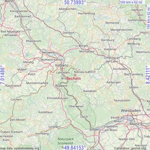
Becheln GPS coordinates[2]
50° 17' 34.26" North, 7° 43' 4.728" East
| Map corner | latitude | longitude |
|---|---|---|
| Upper-left | 50.73993°, | 7.01486° |
| Center: | 50.29285°, | 7.71798° |
| Lower-right: | 49.84153°, | 8.42111° |
| Map W x H: | 99.9×99.9 km | = 62.1×62.1mi |
| max Lat: | 55.01917° ⇑56.9% North |
| Becheln: | 50.29285° |
| min Lat: | ⇓43.1% South 47.40724° |
| min Long | Becheln | max Long |
| 5.92978° | 7.71798° | 14.98853° |
| W 17.4%⇐ | ⇒82.6% E |
Elevation
Elevation of Becheln is 380 m = 1247 ft, and this is 130.9 m = 429 ft above average elevation for this country.
| Max E: |
1256 m = 4121 ft | 27.2% |
| Becheln | 380 m 1247 ft | |
| Avg. | 249.1 m = 817 ft | |
Min E: |
-5 m = -16 ft | 72.8% |
See also: Germany elevation on elevation.city.
Geographical zone
Becheln is located in North temperate zone (between Tropic of Cancer and the Arctic Circle). Distance of this North polar circle is 1809.1 km =1124.1 mi to North.| Distance of | km | miles | from Becheln |
|---|---|---|---|
| North Pole | 4415 | 2743.4 | to North |
| Arctic Circle | 1809.1 | 1124.1 | to North |
| Tropic Cancer | 2986.1 | 1855.5 | to South |
| Equator | 5592 | 3474.7 | to South |


Nearby cities:
15 places around Becheln: (largest is in red/bold)
• Bad Ems
4.7 km =2.9 mi,  356°
356°
• Braubach
5.6 km =3.5 mi,  247°
247°
• Dachsenhausen
4.4 km =2.7 mi,  171°
171°
• Dausenau
5.7 km =3.5 mi,  37°
37°
• Dessighofen
5.5 km =3.4 mi,  135°
135°
• Dienethal
4.4 km =2.7 mi,  73°
73°
• Fachbach
5.1 km =3.2 mi,  331°
331°
• Frücht
3.6 km =2.2 mi,  317°
317°
• Kehlbach
4.7 km =2.9 mi, 142°
• Misselberg
4 km =2.5 mi, 66°
• Nievern
5.1 km =3.2 mi, 331°
• Oberbachheim
5.6 km =3.5 mi,  157°
157°
• Oberwies
4.5 km =2.8 mi,  96°
96°
• Schweighausen
2.5 km =1.6 mi,  114°
114°
• Sulzbach
2.7 km =1.7 mi, 66°
Sources, notices
• [Note1] Compared only with cities in Germany existing in our database
• [Src1] Map data: © OpenStreetMap contributors (CC-BY-SA)
• [Src2] Other city data from geonames.org with taken over terms of usage.
• [Src3] Geographical zone / Annual Mean Temperature by Robert A. Rohde @ Wikipedia
