Frücht geodata
Frücht (Rheinland-Pfalz) is a seat of a fourth-order administrative division; located in Germany in Europe/Berlin (GMT+2) time zone. With population of 609 people, there are 8769 cities with bigger population in this country. Compared to other cities in Germany, 56.5% of cities are located further ↑North; 83.4% of cities are located further →East and 52.3% of cities have lower elevation than Frücht. Note1


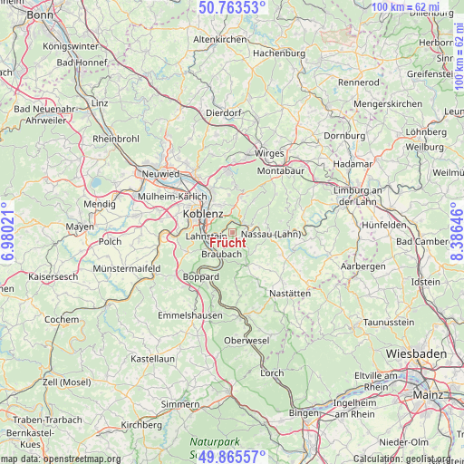
Frücht GPS coordinates[2]
50° 19' 0.012" North, 7° 40' 59.988" East
| Map corner | latitude | longitude |
|---|---|---|
| Upper-left | 50.76353°, | 6.98021° |
| Center: | 50.31667°, | 7.68333° |
| Lower-right: | 49.86557°, | 8.38646° |
| Map W x H: | 99.8×99.8 km | = 62×62mi |
| max Lat: | 55.01917° ⇑56.5% North |
| Frücht: | 50.31667° |
| min Lat: | ⇓43.5% South 47.40724° |
| min Long | Frücht | max Long |
| 5.92978° | 7.68333° | 14.98853° |
| W 16.6%⇐ | ⇒83.4% E |
Elevation
Elevation of Frücht is 242 m = 794 ft, and this is 7.1 m = 23 ft below average elevation for this country.
| Max E: |
1256 m = 4121 ft | 47.7% |
| Avg. | 249.1 m = 817 ft | |
| Frücht | 242 m = 794 ft | |
Min E: |
-5 m = -16 ft | 52.3% |
See also: Germany elevation on elevation.city.
Geographical zone
Frücht is located in North temperate zone (between Tropic of Cancer and the Arctic Circle). Distance of this North polar circle is 1806.5 km =1122.5 mi to North.| Distance of | km | miles | from Frücht |
|---|---|---|---|
| North Pole | 4412.4 | 2741.7 | to North |
| Arctic Circle | 1806.5 | 1122.5 | to North |
| Tropic Cancer | 2988.8 | 1857.2 | to South |
| Equator | 5594.7 | 3476.4 | to South |


Nearby cities:
15 places around Frücht: (largest is in red/bold)
• Bad Ems
3 km =1.9 mi,  45°
45°
• Becheln
3.6 km =2.2 mi,  137°
137°
• Braubach
5.5 km =3.4 mi,  209°
209°
• Brey
6.4 km =4 mi,  219°
219°
• Dausenau
6.2 km =3.9 mi,  72°
72°
• Dienethal
6.8 km =4.2 mi,  101°
101°
• Fachbach
1.9 km =1.2 mi,  0°
0°
• Kemmenau
6 km =3.7 mi, 51°
• Lahnstein
5.1 km =3.2 mi,  248°
248°
• Miellen
2.2 km =1.4 mi,  327°
327°
• Misselberg
6.2 km =3.9 mi, 100°
• Nievern
1.9 km =1.2 mi, 0°
• Rhens
6.1 km =3.8 mi,  229°
229°
• Schweighausen
6 km =3.7 mi,  128°
128°
• Sulzbach
5.1 km =3.2 mi,  107°
107°
Sources, notices
• [Note1] Compared only with cities in Germany existing in our database
• [Src1] Map data: © OpenStreetMap contributors (CC-BY-SA)
• [Src2] Other city data from geonames.org with taken over terms of usage.
• [Src3] Geographical zone / Annual Mean Temperature by Robert A. Rohde @ Wikipedia
