Balgstädt geodata
Balgstädt (Saxony-Anhalt) is a seat of a fourth-order administrative division; located in Germany in Europe/Berlin (GMT+2) time zone. With population of 666 people, there are 8492 cities with bigger population in this country. Compared to other cities in Germany, 61.7% of cities are located further ↓South; 77.7% of cities are located further ←West and 65.4% of cities have higher elevation than Balgstädt. Note1


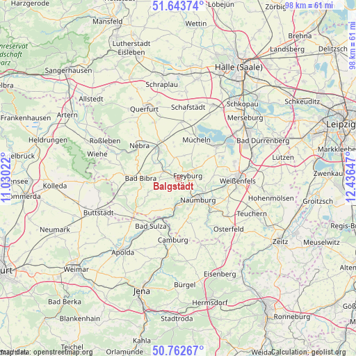
Balgstädt GPS coordinates[2]
51° 12' 19.116" North, 11° 44' 0.024" East
| Map corner | latitude | longitude |
|---|---|---|
| Upper-left | 51.64374°, | 11.03022° |
| Center: | 51.20531°, | 11.73334° |
| Lower-right: | 50.76267°, | 12.43647° |
| Map W x H: | 98×98 km | = 60.9×60.9mi |
| max Lat: | 55.01917° ⇑38.3% North |
| Balgstädt: | 51.20531° |
| min Lat: | ⇓61.7% South 47.40724° |
| min Long | Balgstädt | max Long |
| 5.92978° | 11.73334° | 14.98853° |
| W 77.7%⇐ | ⇒22.3% E |
Elevation
Elevation of Balgstädt is 118 m = 387 ft, and this is 131.1 m = 430 ft below average elevation for this country.
| Max E: |
1256 m = 4121 ft | 65.4% |
| Avg. | 249.1 m = 817 ft | |
| Balgstädt | 118 m = 387 ft | |
Min E: |
-5 m = -16 ft | 34.6% |
See also: Germany elevation on elevation.city.
Geographical zone
Balgstädt is located in North temperate zone (between Tropic of Cancer and the Arctic Circle). Distance of this North polar circle is 1707.7 km =1061.1 mi to North.| Distance of | km | miles | from Balgstädt |
|---|---|---|---|
| North Pole | 4313.6 | 2680.3 | to North |
| Arctic Circle | 1707.7 | 1061.1 | to North |
| Tropic Cancer | 3087.6 | 1918.5 | to South |
| Equator | 5693.5 | 3537.8 | to South |


Nearby cities:
15 places around Balgstädt: (largest is in red/bold)
• Bad Bibra
10.3 km =6.4 mi,  271°
271°
• Bad Kösen
7.9 km =4.9 mi,  185°
185°
• Burgscheidungen
7.9 km =4.9 mi,  306°
306°
• Freyburg
2.6 km =1.6 mi,  69°
69°
• Gleina
5.9 km =3.7 mi,  351°
351°
• Goseck
9.3 km =5.8 mi,  93°
93°
• Gröst
10.1 km =6.3 mi,  53°
53°
• Karsdorf
9 km =5.6 mi,  324°
324°
• Klosterhäseler
9.6 km =6 mi,  241°
241°
• Laucha
4.3 km =2.7 mi,  299°
299°
• Lengefeld
10 km =6.2 mi, 188°
• Mücheln
11.4 km =7.1 mi,  26°
26°
• Naumburg
8.1 km =5 mi,  139°
139°
• Schönburg
10.2 km =6.3 mi,  114°
114°
• Taugwitz
11.2 km =7 mi,  217°
217°
Sources, notices
• [Note1] Compared only with cities in Germany existing in our database
• [Src1] Map data: © OpenStreetMap contributors (CC-BY-SA)
• [Src2] Other city data from geonames.org with taken over terms of usage.
• [Src3] Geographical zone / Annual Mean Temperature by Robert A. Rohde @ Wikipedia
