Bad Saarow geodata
Bad Saarow (Brandenburg) is a seat of a fourth-order administrative division; located in Germany in Europe/Berlin (GMT+2) time zone. With population of 4,594 people, there are 2988 cities with bigger population in this country. Compared to other cities in Germany, 75% of cities are located further ↓South; 98.2% of cities are located further ←West and 78.3% of cities have higher elevation than Bad Saarow. Note1


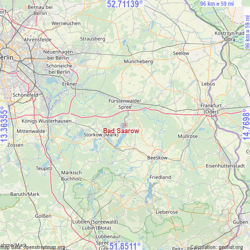
Bad Saarow GPS coordinates[2]
52° 16' 59.988" North, 14° 4' 0.012" East
| Map corner | latitude | longitude |
|---|---|---|
| Upper-left | 52.71139°, | 13.36355° |
| Center: | 52.28333°, | 14.06667° |
| Lower-right: | 51.8511°, | 14.7698° |
| Map W x H: | 95.7×95.7 km | = 59.5×59.5mi |
| max Lat: | 55.01917° ⇑25% North |
| Bad Saarow: | 52.28333° |
| min Lat: | ⇓75% South 47.40724° |
| min Long | Bad Saarow | max Long |
| 5.92978° | 14.06667° | 14.98853° |
| W 98.2%⇐ | ⇒1.8% E |
Elevation
Elevation of Bad Saarow is 52 m = 171 ft, and this is 197.1 m = 647 ft below average elevation for this country.
| Max E: |
1256 m = 4121 ft | 78.3% |
| Avg. | 249.1 m = 817 ft | |
| Bad Saarow | 52 m = 171 ft | |
Min E: |
-5 m = -16 ft | 21.7% |
See also: Germany elevation on elevation.city.
Geographical zone
Bad Saarow is located in North temperate zone (between Tropic of Cancer and the Arctic Circle). Distance of this North polar circle is 1587.8 km =986.6 mi to North.| Distance of | km | miles | from Bad Saarow |
|---|---|---|---|
| North Pole | 4193.7 | 2605.8 | to North |
| Arctic Circle | 1587.8 | 986.6 | to North |
| Tropic Cancer | 3207.4 | 1993 | to South |
| Equator | 5813.4 | 3612.3 | to South |


Nearby cities:
15 places around Bad Saarow: (largest is in red/bold)
• Beeskow
17.3 km =10.7 mi,  135°
135°
• Berkenbrück
9.3 km =5.8 mi,  37°
37°
• Briesen
15.9 km =9.9 mi,  64°
64°
• Diensdorf-Radlow
3.9 km =2.4 mi,  197°
197°
• Fürstenwalde
8.6 km =5.3 mi,  357°
357°
• Jacobsdorf
20 km =12.4 mi,  73°
73°
• Langewahl
6 km =3.7 mi,  22°
22°
• Rauen
6 km =3.7 mi,  334°
334°
• Reichenwalde
4.9 km =3 mi,  247°
247°
• Rietz Neuendorf
9.6 km =6 mi,  130°
130°
• Spreenhagen
14.5 km =9 mi,  297°
297°
• Steinhöfel
14.6 km =9.1 mi,  27°
27°
• Storkow
9.5 km =5.9 mi, 251°
• Tauche
16.3 km =10.1 mi,  155°
155°
• Wendisch Rietz
8.5 km =5.3 mi,  207°
207°
Sources, notices
• [Note1] Compared only with cities in Germany existing in our database
• [Src1] Map data: © OpenStreetMap contributors (CC-BY-SA)
• [Src2] Other city data from geonames.org with taken over terms of usage.
• [Src3] Geographical zone / Annual Mean Temperature by Robert A. Rohde @ Wikipedia
