Spreenhagen geodata
Spreenhagen (Brandenburg) is a seat of a fourth-order administrative division; located in Germany in Europe/Berlin (GMT+2) time zone. With population of 3,530 people, there are 3592 cities with bigger population in this country. Compared to other cities in Germany, 75.6% of cities are located further ↓South; 97.5% of cities are located further ←West and 84.1% of cities have higher elevation than Spreenhagen. Note1


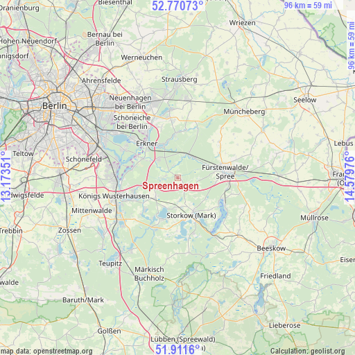
Spreenhagen GPS coordinates[2]
52° 20' 35.7" North, 13° 52' 35.868" East
| Map corner | latitude | longitude |
|---|---|---|
| Upper-left | 52.77073°, | 13.17351° |
| Center: | 52.34325°, | 13.87663° |
| Lower-right: | 51.9116°, | 14.57976° |
| Map W x H: | 95.5×95.5 km | = 59.3×59.3mi |
| max Lat: | 55.01917° ⇑24.4% North |
| Spreenhagen: | 52.34325° |
| min Lat: | ⇓75.6% South 47.40724° |
| min Long | Spreenhagen | max Long |
| 5.92978° | 13.87663° | 14.98853° |
| W 97.5%⇐ | ⇒2.5% E |
Elevation
Elevation of Spreenhagen is 37 m = 121 ft, and this is 212.1 m = 696 ft below average elevation for this country.
| Max E: |
1256 m = 4121 ft | 84.1% |
| Avg. | 249.1 m = 817 ft | |
| Spreenhagen | 37 m = 121 ft | |
Min E: |
-5 m = -16 ft | 15.9% |
See also: Germany elevation on elevation.city.
Geographical zone
Spreenhagen is located in North temperate zone (between Tropic of Cancer and the Arctic Circle). Distance of this North polar circle is 1581.2 km =982.5 mi to North.| Distance of | km | miles | from Spreenhagen |
|---|---|---|---|
| North Pole | 4187 | 2601.7 | to North |
| Arctic Circle | 1581.2 | 982.5 | to North |
| Tropic Cancer | 3214.1 | 1997.1 | to South |
| Equator | 5820 | 3616.4 | to South |


Nearby cities:
15 places around Spreenhagen: (largest is in red/bold)
• Bad Saarow
14.5 km =9 mi,  117°
117°
• Diensdorf-Radlow
15.7 km =9.8 mi,  131°
131°
• Erkner
11.9 km =7.4 mi,  315°
315°
• Fürstenwalde
12.7 km =7.9 mi,  81°
81°
• Grünheide
9.9 km =6.2 mi,  334°
334°
• Langewahl
15.2 km =9.4 mi,  94°
94°
• Müggelheim
16.3 km =10.1 mi,  297°
297°
• Rahnsdorf
16.8 km =10.4 mi,  310°
310°
• Rauen
10.4 km =6.5 mi,  96°
96°
• Reichenwalde
12 km =7.5 mi,  135°
135°
• Schmöckwitz
15.8 km =9.8 mi,  282°
282°
• Storkow
10.4 km =6.5 mi,  158°
158°
• Wendisch Rietz
16.7 km =10.4 mi,  147°
147°
• Wildau
16.8 km =10.4 mi,  259°
259°
• Woltersdorf
15.2 km =9.4 mi, 325°
Sources, notices
• [Note1] Compared only with cities in Germany existing in our database
• [Src1] Map data: © OpenStreetMap contributors (CC-BY-SA)
• [Src2] Other city data from geonames.org with taken over terms of usage.
• [Src3] Geographical zone / Annual Mean Temperature by Robert A. Rohde @ Wikipedia
