Bad Gandersheim geodata
Bad Gandersheim (Lower Saxony) is a populated place; located in Germany in Europe/Berlin (GMT+2) time zone. With population of 11,099 people, there are 1489 cities with bigger population in this country. Compared to other cities in Germany, 70.8% of cities are located further ↓South; 50.5% of cities are located further ←West and 64.6% of cities have higher elevation than Bad Gandersheim. Note1
Administrative division(s):
- Level 1: Lower Saxony
- Level 3: Landkreis Northeim
- Level 4: Bad Gandersheim


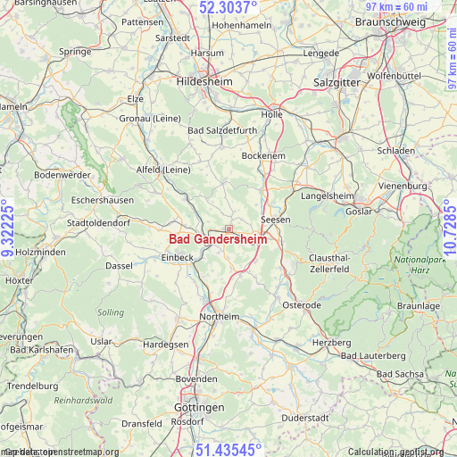
Bad Gandersheim GPS coordinates[2]
51° 52' 18.012" North, 10° 1' 31.332" East
| Map corner | latitude | longitude |
|---|---|---|
| Upper-left | 52.3037°, | 9.32225° |
| Center: | 51.87167°, | 10.02537° |
| Lower-right: | 51.43545°, | 10.7285° |
| Map W x H: | 96.5×96.5 km | = 60×60mi |
| max Lat: | 55.01917° ⇑29.2% North |
| Bad Gandersheim: | 51.87167° |
| min Lat: | ⇓70.8% South 47.40724° |
| min Long | Bad Gandersheim | max Long |
| 5.92978° | 10.02537° | 14.98853° |
| W 50.5%⇐ | ⇒49.5% E |
Elevation
Elevation of Bad Gandersheim is 123 m = 404 ft, and this is 126.1 m = 414 ft below average elevation for this country.
| Max E: |
1256 m = 4121 ft | 64.6% |
| Avg. | 249.1 m = 817 ft | |
| Bad Gandersheim | 123 m = 404 ft | |
Min E: |
-5 m = -16 ft | 35.4% |
See also: Germany elevation on elevation.city.
Geographical zone
Bad Gandersheim is located in North temperate zone (between Tropic of Cancer and the Arctic Circle). Distance of this North polar circle is 1633.6 km =1015.1 mi to North.| Distance of | km | miles | from Bad Gandersheim |
|---|---|---|---|
| North Pole | 4239.5 | 2634.3 | to North |
| Arctic Circle | 1633.6 | 1015.1 | to North |
| Tropic Cancer | 3161.7 | 1964.6 | to South |
| Equator | 5767.6 | 3583.8 | to South |


Nearby cities:
15 places around Bad Gandersheim: (largest is in red/bold)
• Adenstedt
15.4 km =9.6 mi,  336°
336°
• Einbeck
12.1 km =7.5 mi,  241°
241°
• Everode
11.5 km =7.1 mi,  319°
319°
• Freden
11 km =6.8 mi,  304°
304°
• Gittelde
13.8 km =8.6 mi,  126°
126°
• Hahausen
15.7 km =9.8 mi,  56°
56°
• Harbarnsen
13.1 km =8.1 mi, 342°
• Kalefeld
8 km =5 mi,  176°
176°
• Kreiensen
4.6 km =2.9 mi, 244°
• Lamspringe
9.9 km =6.2 mi,  354°
354°
• Neuhof
12.5 km =7.8 mi,  7°
7°
• Seesen
10.7 km =6.6 mi,  78°
78°
• Windhausen
16 km =9.9 mi, 126°
• Winzenburg
9.3 km =5.8 mi, 317°
• Woltershausen
13.4 km =8.3 mi, 337°
Sources, notices
• [Note1] Compared only with cities in Germany existing in our database
• [Src1] Map data: © OpenStreetMap contributors (CC-BY-SA)
• [Src2] Other city data from geonames.org with taken over terms of usage.
• [Src3] Geographical zone / Annual Mean Temperature by Robert A. Rohde @ Wikipedia
