Auhausen geodata
Auhausen (Bavaria) is a seat of a fourth-order administrative division; located in Germany in Europe/Berlin (GMT+2) time zone. With population of 1,107 people, there are 6830 cities with bigger population in this country. Compared to other cities in Germany, 82.9% of cities are located further ↑North; 61.2% of cities are located further ←West and 78.9% of cities have lower elevation than Auhausen. Note1
Administrative division(s):
- Level 1: Bavaria
- Level 2: Swabia
- Level 3: Landkreis Donau-Ries
- Level 4: Auhausen


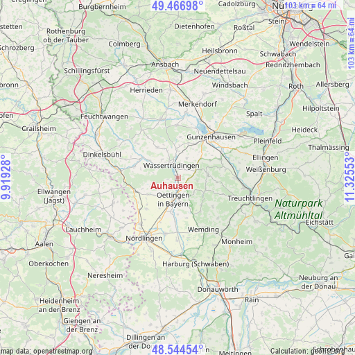
Auhausen GPS coordinates[2]
49° 0' 28.44" North, 10° 37' 20.64" East
| Map corner | latitude | longitude |
|---|---|---|
| Upper-left | 49.46698°, | 9.91928° |
| Center: | 49.0079°, | 10.6224° |
| Lower-right: | 48.54454°, | 11.32553° |
| Map W x H: | 102.6×102.6 km | = 63.8×63.8mi |
| max Lat: | 55.01917° ⇑82.9% North |
| Auhausen: | 49.0079° |
| min Lat: | ⇓17.1% South 47.40724° |
| min Long | Auhausen | max Long |
| 5.92978° | 10.6224° | 14.98853° |
| W 61.2%⇐ | ⇒38.8% E |
Elevation
Elevation of Auhausen is 426 m = 1398 ft, and this is 176.9 m = 580 ft above average elevation for this country.
| Max E: |
1256 m = 4121 ft | 21.1% |
| Auhausen | 426 m 1398 ft | |
| Avg. | 249.1 m = 817 ft | |
Min E: |
-5 m = -16 ft | 78.9% |
See also: Germany elevation on elevation.city.
Geographical zone
Auhausen is located in North temperate zone (between Tropic of Cancer and the Arctic Circle). Distance of this North polar circle is 1952 km =1212.9 mi to North.| Distance of | km | miles | from Auhausen |
|---|---|---|---|
| North Pole | 4557.9 | 2832.1 | to North |
| Arctic Circle | 1952 | 1212.9 | to North |
| Tropic Cancer | 2843.2 | 1766.7 | to South |
| Equator | 5449.2 | 3386 | to South |


Nearby cities:
15 places around Auhausen: (largest is in red/bold)
• Ehingen
10.6 km =6.6 mi,  325°
325°
• Gerolfingen
9.5 km =5.9 mi,  302°
302°
• Gnotzheim
8.8 km =5.5 mi,  48°
48°
• Hainsfarth
5.5 km =3.4 mi,  178°
178°
• Heidenheim
8.9 km =5.5 mi,  83°
83°
• Maihingen
12.7 km =7.9 mi,  225°
225°
• Megesheim
8.5 km =5.3 mi,  166°
166°
• Munningen
10.3 km =6.4 mi,  189°
189°
• Oettingen in Bayern
6.3 km =3.9 mi, 191°
• Polsingen
11.7 km =7.3 mi,  146°
146°
• Röckingen
7 km =4.3 mi,  319°
319°
• Unterschwaningen
8 km =5 mi,  359°
359°
• Wassertrüdingen
4.3 km =2.7 mi,  336°
336°
• Westheim
3.3 km =2.1 mi,  105°
105°
• Wittelshofen
11.9 km =7.4 mi, 299°
Sources, notices
• [Note1] Compared only with cities in Germany existing in our database
• [Src1] Map data: © OpenStreetMap contributors (CC-BY-SA)
• [Src2] Other city data from geonames.org with taken over terms of usage.
• [Src3] Geographical zone / Annual Mean Temperature by Robert A. Rohde @ Wikipedia
