Angern geodata
Angern (Saxony-Anhalt) is a seat of a fourth-order administrative division; located in Germany in Europe/Berlin (GMT+2) time zone. With population of 1,380 people, there are 6120 cities with bigger population in this country. Compared to other cities in Germany, 75.7% of cities are located further ↓South; 77.7% of cities are located further ←West and 81.4% of cities have higher elevation than Angern. Note1


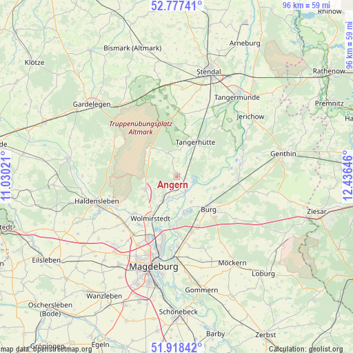
Angern GPS coordinates[2]
52° 21' 0" North, 11° 43' 59.988" East
| Map corner | latitude | longitude |
|---|---|---|
| Upper-left | 52.77741°, | 11.03021° |
| Center: | 52.35°, | 11.73333° |
| Lower-right: | 51.91842°, | 12.43646° |
| Map W x H: | 95.5×95.5 km | = 59.3×59.3mi |
| max Lat: | 55.01917° ⇑24.3% North |
| Angern: | 52.35° |
| min Lat: | ⇓75.7% South 47.40724° |
| min Long | Angern | max Long |
| 5.92978° | 11.73333° | 14.98853° |
| W 77.7%⇐ | ⇒22.3% E |
Elevation
Elevation of Angern is 43 m = 141 ft, and this is 206.1 m = 676 ft below average elevation for this country.
| Max E: |
1256 m = 4121 ft | 81.4% |
| Avg. | 249.1 m = 817 ft | |
| Angern | 43 m = 141 ft | |
Min E: |
-5 m = -16 ft | 18.6% |
See also: Germany elevation on elevation.city.
Geographical zone
Angern is located in North temperate zone (between Tropic of Cancer and the Arctic Circle). Distance of this North polar circle is 1580.4 km =982 mi to North.| Distance of | km | miles | from Angern |
|---|---|---|---|
| North Pole | 4186.3 | 2601.2 | to North |
| Arctic Circle | 1580.4 | 982 | to North |
| Tropic Cancer | 3214.9 | 1997.6 | to South |
| Equator | 5820.8 | 3616.9 | to South |


Nearby cities:
15 places around Angern: (largest is in red/bold)
• Burg bei Magdeburg
12 km =7.5 mi,  136°
136°
• Burgstall
7 km =4.3 mi,  339°
339°
• Colbitz
9.4 km =5.8 mi,  247°
247°
• Dolle
9.9 km =6.2 mi,  311°
311°
• Farsleben
9.7 km =6 mi,  214°
214°
• Glindenberg
12.8 km =8 mi,  195°
195°
• Hohenwarthe
13.4 km =8.3 mi,  185°
185°
• Loitsche
6.2 km =3.9 mi, 201°
• Mahlwinkel
6.1 km =3.8 mi,  35°
35°
• Rogätz
4.3 km =2.7 mi,  148°
148°
• Samswegen
15.3 km =9.5 mi,  229°
229°
• Schermen
14.2 km =8.8 mi,  157°
157°
• Tangerhütte
10.7 km =6.6 mi,  27°
27°
• Wolmirstedt
13.3 km =8.3 mi, 212°
• Zielitz
7.8 km =4.8 mi, 210°
Sources, notices
• [Note1] Compared only with cities in Germany existing in our database
• [Src1] Map data: © OpenStreetMap contributors (CC-BY-SA)
• [Src2] Other city data from geonames.org with taken over terms of usage.
• [Src3] Geographical zone / Annual Mean Temperature by Robert A. Rohde @ Wikipedia
