Altenglan geodata
Altenglan (Rheinland-Pfalz) is a seat of a fourth-order administrative division; located in Germany in Europe/Berlin (GMT+2) time zone. With population of 3,048 people, there are 3963 cities with bigger population in this country. Compared to other cities in Germany, 74.8% of cities are located further ↑North; 87.7% of cities are located further →East and 53.4% of cities have higher elevation than Altenglan. Note1


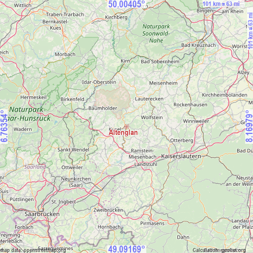
Altenglan GPS coordinates[2]
49° 33' 0" North, 7° 28' 0.012" East
| Map corner | latitude | longitude |
|---|---|---|
| Upper-left | 50.00405°, | 6.76354° |
| Center: | 49.55°, | 7.46667° |
| Lower-right: | 49.09169°, | 8.16979° |
| Map W x H: | 101.4×101.4 km | = 63×63mi |
| max Lat: | 55.01917° ⇑74.8% North |
| Altenglan: | 49.55° |
| min Lat: | ⇓25.2% South 47.40724° |
| min Long | Altenglan | max Long |
| 5.92978° | 7.46667° | 14.98853° |
| W 12.3%⇐ | ⇒87.7% E |
Elevation
Elevation of Altenglan is 201 m = 659 ft, and this is 48.1 m = 158 ft below average elevation for this country.
| Max E: |
1256 m = 4121 ft | 53.4% |
| Avg. | 249.1 m = 817 ft | |
| Altenglan | 201 m = 659 ft | |
Min E: |
-5 m = -16 ft | 46.6% |
See also: Germany elevation on elevation.city.
Geographical zone
Altenglan is located in North temperate zone (between Tropic of Cancer and the Arctic Circle). Distance of this North polar circle is 1891.7 km =1175.4 mi to North.| Distance of | km | miles | from Altenglan |
|---|---|---|---|
| North Pole | 4497.6 | 2794.7 | to North |
| Arctic Circle | 1891.7 | 1175.4 | to North |
| Tropic Cancer | 2903.5 | 1804.2 | to South |
| Equator | 5509.4 | 3423.4 | to South |


Nearby cities:
15 places around Altenglan: (largest is in red/bold)
• Bedesbach
2.2 km =1.4 mi,  342°
342°
• Blaubach
5.2 km =3.2 mi,  291°
291°
• Bosenbach
4.7 km =2.9 mi,  103°
103°
• Elzweiler
5.2 km =3.2 mi,  44°
44°
• Erdesbach
3.2 km =2 mi,  326°
326°
• Etschberg
4.4 km =2.7 mi,  212°
212°
• Föckelberg
2.2 km =1.4 mi,  147°
147°
• Haschbach am Remigiusberg
3 km =1.9 mi,  232°
232°
• Kusel
4.7 km =2.9 mi,  253°
253°
• Niederstaufenbach
4.1 km =2.5 mi,  117°
117°
• Oberstaufenbach
4.9 km =3 mi,  140°
140°
• Rammelsbach
1.9 km =1.2 mi,  240°
240°
• Theisbergstegen
3.8 km =2.4 mi,  199°
199°
• Ulmet
3.9 km =2.4 mi, 342°
• Welchweiler
4.4 km =2.7 mi,  32°
32°
Sources, notices
• [Note1] Compared only with cities in Germany existing in our database
• [Src1] Map data: © OpenStreetMap contributors (CC-BY-SA)
• [Src2] Other city data from geonames.org with taken over terms of usage.
• [Src3] Geographical zone / Annual Mean Temperature by Robert A. Rohde @ Wikipedia
