Oberstaufenbach geodata
Oberstaufenbach (Rheinland-Pfalz) is a seat of a fourth-order administrative division; located in Germany in Europe/Berlin (GMT+2) time zone. With population of 272 people, there are 10160 cities with bigger population in this country. Compared to other cities in Germany, 75.4% of cities are located further ↑North; 86.8% of cities are located further →East and 56.2% of cities have lower elevation than Oberstaufenbach. Note1
Administrative division(s):
- Level 1: Rheinland-Pfalz
- Level 3: Landkreis Kusel
- Level 4: Oberstaufenbach


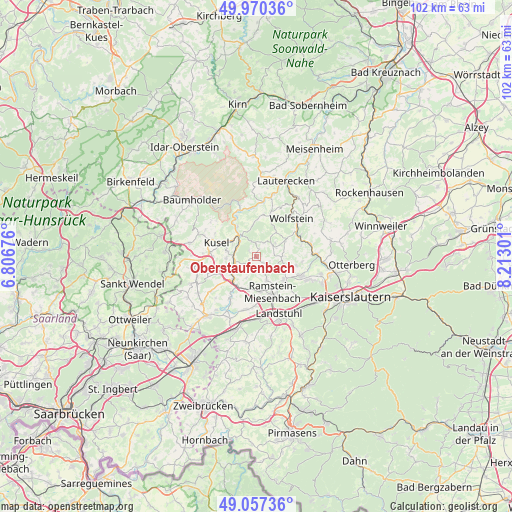
Oberstaufenbach GPS coordinates[2]
49° 30' 57.564" North, 7° 30' 35.568" East
| Map corner | latitude | longitude |
|---|---|---|
| Upper-left | 49.97036°, | 6.80676° |
| Center: | 49.51599°, | 7.50988° |
| Lower-right: | 49.05736°, | 8.21301° |
| Map W x H: | 101.5×101.5 km | = 63.1×63.1mi |
| max Lat: | 55.01917° ⇑75.4% North |
| Oberstaufenbach: | 49.51599° |
| min Lat: | ⇓24.6% South 47.40724° |
| min Long | Oberstaufenbach | max Long |
| 5.92978° | 7.50988° | 14.98853° |
| W 13.2%⇐ | ⇒86.8% E |
Elevation
Elevation of Oberstaufenbach is 267 m = 876 ft, and this is 17.9 m = 59 ft above average elevation for this country.
| Max E: |
1256 m = 4121 ft | 43.8% |
| Oberstaufenbach | 267 m 876 ft | |
| Avg. | 249.1 m = 817 ft | |
Min E: |
-5 m = -16 ft | 56.2% |
See also: Germany elevation on elevation.city.
Geographical zone
Oberstaufenbach is located in North temperate zone (between Tropic of Cancer and the Arctic Circle). Distance of this North polar circle is 1895.5 km =1177.8 mi to North.| Distance of | km | miles | from Oberstaufenbach |
|---|---|---|---|
| North Pole | 4501.4 | 2797 | to North |
| Arctic Circle | 1895.5 | 1177.8 | to North |
| Tropic Cancer | 2899.7 | 1801.8 | to South |
| Equator | 5505.7 | 3421.1 | to South |


Nearby cities:
15 places around Oberstaufenbach: (largest is in red/bold)
• Altenglan
4.9 km =3 mi,  320°
320°
• Bosenbach
3.1 km =1.9 mi,  28°
28°
• Etschberg
5.5 km =3.4 mi,  270°
270°
• Föckelberg
2.7 km =1.7 mi, 315°
• Haschbach am Remigiusberg
5.9 km =3.7 mi,  289°
289°
• Jettenbach
4 km =2.5 mi,  58°
58°
• Kollweiler
5.3 km =3.3 mi,  89°
89°
• Kottweiler-Schwanden
4 km =2.5 mi,  154°
154°
• Matzenbach
3.6 km =2.2 mi,  240°
240°
• Neunkirchen am Potzberg
2.6 km =1.6 mi,  227°
227°
• Niederstaufenbach
2 km =1.2 mi,  14°
14°
• Rammelsbach
5.6 km =3.5 mi,  300°
300°
• Rehweiler
5.9 km =3.7 mi, 235°
• Reichenbach-Steegen
3.4 km =2.1 mi,  121°
121°
• Theisbergstegen
4.4 km =2.7 mi, 272°
Sources, notices
• [Note1] Compared only with cities in Germany existing in our database
• [Src1] Map data: © OpenStreetMap contributors (CC-BY-SA)
• [Src2] Other city data from geonames.org with taken over terms of usage.
• [Src3] Geographical zone / Annual Mean Temperature by Robert A. Rohde @ Wikipedia
