Alpirsbach geodata
Alpirsbach (Baden-Württemberg) is a populated place; located in Germany in Europe/Berlin (GMT+2) time zone. With population of 7,011 people, there are 2181 cities with bigger population in this country. Compared to other cities in Germany, 90.8% of cities are located further ↑North; 71.9% of cities are located further →East and 80.2% of cities have lower elevation than Alpirsbach. Note1
Administrative division(s):
- Level 1: Baden-Württemberg
- Level 2: Karlsruhe Region
- Level 3: Landkreis Freudenstadt
- Level 4: Alpirsbach


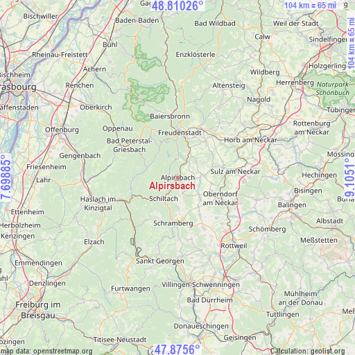
Alpirsbach GPS coordinates[2]
48° 20' 42.252" North, 8° 24' 7.092" East
| Map corner | latitude | longitude |
|---|---|---|
| Upper-left | 48.81026°, | 7.69885° |
| Center: | 48.34507°, | 8.40197° |
| Lower-right: | 47.8756°, | 9.1051° |
| Map W x H: | 103.9×103.9 km | = 64.6×64.6mi |
| max Lat: | 55.01917° ⇑90.8% North |
| Alpirsbach: | 48.34507° |
| min Lat: | ⇓9.2% South 47.40724° |
| min Long | Alpirsbach | max Long |
| 5.92978° | 8.40197° | 14.98853° |
| W 28.1%⇐ | ⇒71.9% E |
Elevation
Elevation of Alpirsbach is 434 m = 1424 ft, and this is 184.9 m = 607 ft above average elevation for this country.
| Max E: |
1256 m = 4121 ft | 19.8% |
| Alpirsbach | 434 m 1424 ft | |
| Avg. | 249.1 m = 817 ft | |
Min E: |
-5 m = -16 ft | 80.2% |
See also: Germany elevation on elevation.city.
Geographical zone
Alpirsbach is located in North temperate zone (between Tropic of Cancer and the Arctic Circle). Distance of this North polar circle is 2025.7 km =1258.7 mi to North.| Distance of | km | miles | from Alpirsbach |
|---|---|---|---|
| North Pole | 4631.6 | 2877.9 | to North |
| Arctic Circle | 2025.7 | 1258.7 | to North |
| Tropic Cancer | 2769.5 | 1720.9 | to South |
| Equator | 5375.5 | 3340.2 | to South |


Nearby cities:
15 places around Alpirsbach: (largest is in red/bold)
• Aichhalden
8.7 km =5.4 mi,  179°
179°
• Bad Rippoldsau-Schapbach
10.9 km =6.8 mi,  328°
328°
• Dornhan
7.9 km =4.9 mi,  85°
85°
• Dornstetten
15.8 km =9.8 mi,  26°
26°
• Freudenstadt
13.6 km =8.5 mi,  3°
3°
• Glatten
13.5 km =8.4 mi,  36°
36°
• Lauterbach/Schwarzwald
13.5 km =8.4 mi,  199°
199°
• Loßburg
7.1 km =4.4 mi, 30°
• Oberndorf
14 km =8.7 mi,  115°
115°
• Oberwolfach
14.1 km =8.8 mi,  257°
257°
• Schenkenzell
4.3 km =2.7 mi,  210°
210°
• Schiltach
7.6 km =4.7 mi,  215°
215°
• Schramberg
13.5 km =8.4 mi,  185°
185°
• Seedorf
12.5 km =7.8 mi,  148°
148°
• Wolfach
14.9 km =9.3 mi,  247°
247°
Sources, notices
• [Note1] Compared only with cities in Germany existing in our database
• [Src1] Map data: © OpenStreetMap contributors (CC-BY-SA)
• [Src2] Other city data from geonames.org with taken over terms of usage.
• [Src3] Geographical zone / Annual Mean Temperature by Robert A. Rohde @ Wikipedia
