Allmendingen geodata
Allmendingen (Baden-Württemberg) is a seat of a fourth-order administrative division; located in Germany in Europe/Berlin (GMT+2) time zone. With population of 4,556 people, there are 3007 cities with bigger population in this country. Compared to other cities in Germany, 90.9% of cities are located further ↑North; 53.9% of cities are located further →East and 90.4% of cities have lower elevation than Allmendingen. Note1
Administrative division(s):
- Level 1: Baden-Württemberg
- Level 2: Tübingen Region
- Level 3: Alb-Donau-Kreis
- Level 4: Allmendingen


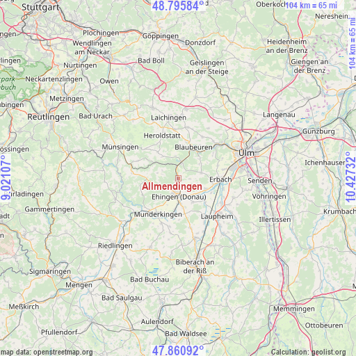
Allmendingen GPS coordinates[2]
48° 19' 49.872" North, 9° 43' 27.084" East
| Map corner | latitude | longitude |
|---|---|---|
| Upper-left | 48.79584°, | 9.02107° |
| Center: | 48.33052°, | 9.72419° |
| Lower-right: | 47.86092°, | 10.42732° |
| Map W x H: | 104×104 km | = 64.6×64.6mi |
| max Lat: | 55.01917° ⇑90.9% North |
| Allmendingen: | 48.33052° |
| min Lat: | ⇓9.1% South 47.40724° |
| min Long | Allmendingen | max Long |
| 5.92978° | 9.72419° | 14.98853° |
| W 46.1%⇐ | ⇒53.9% E |
Elevation
Elevation of Allmendingen is 518 m = 1699 ft, and this is 268.9 m = 882 ft above average elevation for this country.
| Max E: |
1256 m = 4121 ft | 9.6% |
| Allmendingen | 518 m 1699 ft | |
| Avg. | 249.1 m = 817 ft | |
Min E: |
-5 m = -16 ft | 90.4% |
See also: Germany elevation on elevation.city.
Geographical zone
Allmendingen is located in North temperate zone (between Tropic of Cancer and the Arctic Circle). Distance of this North polar circle is 2027.3 km =1259.7 mi to North.| Distance of | km | miles | from Allmendingen |
|---|---|---|---|
| North Pole | 4633.2 | 2878.9 | to North |
| Arctic Circle | 2027.3 | 1259.7 | to North |
| Tropic Cancer | 2767.9 | 1719.9 | to South |
| Equator | 5373.9 | 3339.2 | to South |


Nearby cities:
15 places around Allmendingen: (largest is in red/bold)
• Altheim
3.4 km =2.1 mi,  94°
94°
• Blaubeuren
10.1 km =6.3 mi,  26°
26°
• Dettingen
7.6 km =4.7 mi,  181°
181°
• Ehingen
5.3 km =3.3 mi, 177°
• Erbach
12.1 km =7.5 mi, 91°
• Ersingen
10.6 km =6.6 mi,  113°
113°
• Griesingen
8.3 km =5.2 mi,  148°
148°
• Lauterach
13.5 km =8.4 mi,  232°
232°
• Mehrstetten
12.7 km =7.9 mi,  293°
293°
• Munderkingen
12.1 km =7.5 mi,  209°
209°
• Oberdischingen
8.8 km =5.5 mi, 112°
• Rottenacker
10.9 km =6.8 mi,  193°
193°
• Schelklingen
5.1 km =3.2 mi,  7°
7°
• Untermarchtal
13.2 km =8.2 mi,  219°
219°
• Öpfingen
7.6 km =4.7 mi,  130°
130°
Sources, notices
• [Note1] Compared only with cities in Germany existing in our database
• [Src1] Map data: © OpenStreetMap contributors (CC-BY-SA)
• [Src2] Other city data from geonames.org with taken over terms of usage.
• [Src3] Geographical zone / Annual Mean Temperature by Robert A. Rohde @ Wikipedia
