Altheim geodata
Altheim (Baden-Württemberg) is a seat of a fourth-order administrative division; located in Germany in Europe/Berlin (GMT+2) time zone. In our database, there are 11009 cities with bigger population. Compared to other cities in Germany, 90.9% of cities are located further ↑North; 53.2% of cities are located further →East and 94.9% of cities have lower elevation than Altheim. Note1
Administrative division(s):
- Level 1: Baden-Württemberg
- Level 2: Tübingen Region
- Level 3: Alb-Donau-Kreis
- Level 4: Altheim


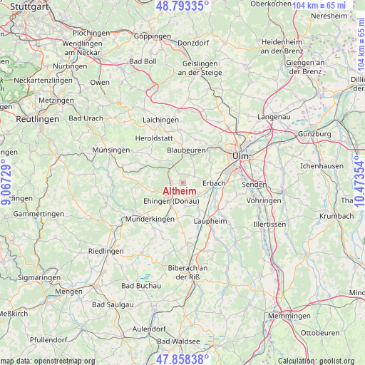
Altheim GPS coordinates[2]
48° 19' 40.836" North, 9° 46' 13.476" East
| Map corner | latitude | longitude |
|---|---|---|
| Upper-left | 48.79335°, | 9.06729° |
| Center: | 48.32801°, | 9.77041° |
| Lower-right: | 47.85838°, | 10.47354° |
| Map W x H: | 104×104 km | = 64.6×64.6mi |
| max Lat: | 55.01917° ⇑90.9% North |
| Altheim: | 48.32801° |
| min Lat: | ⇓9.1% South 47.40724° |
| min Long | Altheim | max Long |
| 5.92978° | 9.77041° | 14.98853° |
| W 46.8%⇐ | ⇒53.2% E |
Elevation
Elevation of Altheim is 596 m = 1955 ft, and this is 346.9 m = 1138 ft above average elevation for this country.
| Max E: |
1256 m = 4121 ft | 5.1% |
| Altheim | 596 m 1955 ft | |
| Avg. | 249.1 m = 817 ft | |
Min E: |
-5 m = -16 ft | 94.9% |
See also: Germany elevation on elevation.city.
Geographical zone
Altheim is located in North temperate zone (between Tropic of Cancer and the Arctic Circle). Distance of this North polar circle is 2027.6 km =1259.9 mi to North.| Distance of | km | miles | from Altheim |
|---|---|---|---|
| North Pole | 4633.5 | 2879.1 | to North |
| Arctic Circle | 2027.6 | 1259.9 | to North |
| Tropic Cancer | 2767.7 | 1719.8 | to South |
| Equator | 5373.6 | 3339 | to South |


Nearby cities:
15 places around Altheim: (largest is in red/bold)
• Achstetten
12.1 km =7.5 mi,  129°
129°
• Allmendingen
3.4 km =2.1 mi,  274°
274°
• Blaubeuren
9.4 km =5.8 mi,  6°
6°
• Dettingen
8.1 km =5 mi,  206°
206°
• Ehingen
6 km =3.7 mi, 212°
• Erbach
8.7 km =5.4 mi,  89°
89°
• Ersingen
7.4 km =4.6 mi,  122°
122°
• Griesingen
6.9 km =4.3 mi,  172°
172°
• Hüttisheim
13.8 km =8.6 mi,  112°
112°
• Laupheim
13.7 km =8.5 mi,  144°
144°
• Munderkingen
13.9 km =8.6 mi,  222°
222°
• Oberdischingen
5.6 km =3.5 mi, 123°
• Rottenacker
12 km =7.5 mi, 210°
• Schelklingen
6 km =3.7 mi,  332°
332°
• Öpfingen
5.2 km =3.2 mi,  152°
152°
Sources, notices
• [Note1] Compared only with cities in Germany existing in our database
• [Src1] Map data: © OpenStreetMap contributors (CC-BY-SA)
• [Src2] Other city data from geonames.org with taken over terms of usage.
• [Src3] Geographical zone / Annual Mean Temperature by Robert A. Rohde @ Wikipedia
