Staufen geodata
Staufen (Baden-Württemberg) is a populated place; located in Germany in Europe/Berlin (GMT+2) time zone. With population of 7,779 people, there are 1994 cities with bigger population in this country. Compared to other cities in Germany, 98.2% of cities are located further ↑North; 73.9% of cities are located further →East and 99.9% of cities have lower elevation than Staufen. Note1
Administrative division(s):
- Level 1: Baden-Württemberg
- Level 2: Freiburg Region
- Level 3: Landkreis Waldshut
- Level 4: Grafenhausen


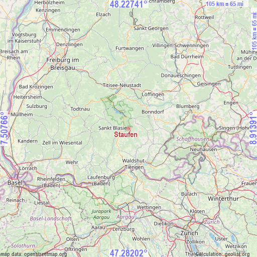
Staufen GPS coordinates[2]
47° 45' 24.696" North, 8° 12' 38.808" East
| Map corner | latitude | longitude |
|---|---|---|
| Upper-left | 48.22741°, | 7.50766° |
| Center: | 47.75686°, | 8.21078° |
| Lower-right: | 47.28202°, | 8.91391° |
| Map W x H: | 105.1×105.1 km | = 65.3×65.3mi |
| max Lat: | 55.01917° ⇑98.2% North |
| Staufen: | 47.75686° |
| min Lat: | ⇓1.8% South 47.40724° |
| min Long | Staufen | max Long |
| 5.92978° | 8.21078° | 14.98853° |
| W 26.1%⇐ | ⇒73.9% E |
Elevation
Elevation of Staufen is 942 m = 3091 ft, and this is 692.9 m = 2273 ft above average elevation for this country.
| Max E: |
1256 m = 4121 ft | 0.099999999999994% |
| Staufen | 942 m 3091 ft | |
| Avg. | 249.1 m = 817 ft | |
Min E: |
-5 m = -16 ft | 99.9% |
See also: Germany elevation on elevation.city.
Geographical zone
Staufen is located in North temperate zone (between Tropic of Cancer and the Arctic Circle). Distance of this North polar circle is 2091.1 km =1299.3 mi to North.| Distance of | km | miles | from Staufen |
|---|---|---|---|
| North Pole | 4697 | 2918.6 | to North |
| Arctic Circle | 2091.1 | 1299.3 | to North |
| Tropic Cancer | 2704.1 | 1680.2 | to South |
| Equator | 5310.1 | 3299.5 | to South |


Nearby cities:
15 places around Staufen: (largest is in red/bold)
• Bernau
13.8 km =8.6 mi,  290°
290°
• Bonndorf
11.9 km =7.4 mi,  54°
54°
• Dachsberg
8.8 km =5.5 mi,  249°
249°
• Eggingen
15.5 km =9.6 mi,  114°
114°
• Grafenhausen
4 km =2.5 mi,  59°
59°
• Häusern
3.4 km =2.1 mi,  256°
256°
• Höchenschwand
4.2 km =2.6 mi,  231°
231°
• Ibach
11.1 km =6.9 mi, 256°
• Lenzkirch
12.4 km =7.7 mi,  357°
357°
• Sankt Blasien
6.3 km =3.9 mi,  275°
275°
• Schluchsee
7 km =4.3 mi,  342°
342°
• Todtmoos
15.7 km =9.8 mi, 263°
• Waldshut-Tiengen
14.9 km =9.3 mi,  178°
178°
• Weilheim
10.2 km =6.3 mi,  170°
170°
• Ühlingen-Birkendorf
9.1 km =5.7 mi,  119°
119°
Sources, notices
• [Note1] Compared only with cities in Germany existing in our database
• [Src1] Map data: © OpenStreetMap contributors (CC-BY-SA)
• [Src2] Other city data from geonames.org with taken over terms of usage.
• [Src3] Geographical zone / Annual Mean Temperature by Robert A. Rohde @ Wikipedia
