Dogern geodata
Dogern (Baden-Württemberg) is a seat of a fourth-order administrative division; located in Germany in Europe/Berlin (GMT+2) time zone. With population of 2,337 people, there are 4619 cities with bigger population in this country. Compared to other cities in Germany, 99.6% of cities are located further ↑North; 74.5% of cities are located further →East and 65.7% of cities have lower elevation than Dogern. Note1
Administrative division(s):
- Level 1: Baden-Württemberg
- Level 2: Freiburg Region
- Level 3: Landkreis Waldshut
- Level 4: Dogern


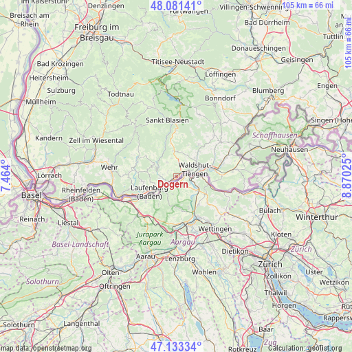
Dogern GPS coordinates[2]
47° 36' 34.272" North, 8° 10' 1.668" East
| Map corner | latitude | longitude |
|---|---|---|
| Upper-left | 48.08141°, | 7.464° |
| Center: | 47.60952°, | 8.16713° |
| Lower-right: | 47.13334°, | 8.87025° |
| Map W x H: | 105.4×105.4 km | = 65.5×65.5mi |
| max Lat: | 55.01917° ⇑99.6% North |
| Dogern: | 47.60952° |
| min Lat: | ⇓0.4% South 47.40724° |
| min Long | Dogern | max Long |
| 5.92978° | 8.16713° | 14.98853° |
| W 25.5%⇐ | ⇒74.5% E |
Elevation
Elevation of Dogern is 326 m = 1070 ft, and this is 76.9 m = 252 ft above average elevation for this country.
| Max E: |
1256 m = 4121 ft | 34.3% |
| Dogern | 326 m 1070 ft | |
| Avg. | 249.1 m = 817 ft | |
Min E: |
-5 m = -16 ft | 65.7% |
See also: Germany elevation on elevation.city.
Geographical zone
Dogern is located in North temperate zone (between Tropic of Cancer and the Arctic Circle). Distance of this North polar circle is 2107.5 km =1309.5 mi to North.| Distance of | km | miles | from Dogern |
|---|---|---|---|
| North Pole | 4713.4 | 2928.8 | to North |
| Arctic Circle | 2107.5 | 1309.5 | to North |
| Tropic Cancer | 2687.8 | 1670.1 | to South |
| Equator | 5293.7 | 3289.4 | to South |


Nearby cities:
15 places around Dogern: (largest is in red/bold)
• Albbruck
3.5 km =2.2 mi,  233°
233°
• Dachsberg
14.3 km =8.9 mi,  339°
339°
• Görwihl
7.8 km =4.8 mi,  298°
298°
• Herrischried
14 km =8.7 mi, 296°
• Häusern
15.6 km =9.7 mi,  359°
359°
• Höchenschwand
13.8 km =8.6 mi, 359°
• Ibach
15.7 km =9.8 mi,  331°
331°
• Lauchringen
11.2 km =7 mi,  80°
80°
• Laufenburg
9.4 km =5.8 mi,  238°
238°
• Murg
12.5 km =7.8 mi, 240°
• Rickenbach
14.2 km =8.8 mi,  274°
274°
• Waldshut-Tiengen
4 km =2.5 mi,  67°
67°
• Weilheim
8.1 km =5 mi,  37°
37°
• Wutöschingen
16 km =9.9 mi, 69°
• Ühlingen-Birkendorf
16.4 km =10.2 mi, 43°
Sources, notices
• [Note1] Compared only with cities in Germany existing in our database
• [Src1] Map data: © OpenStreetMap contributors (CC-BY-SA)
• [Src2] Other city data from geonames.org with taken over terms of usage.
• [Src3] Geographical zone / Annual Mean Temperature by Robert A. Rohde @ Wikipedia
