Garbsen-Mitte geodata
Garbsen-Mitte (Lower Saxony) is a seat of a fourth-order administrative division; located in Germany in Europe/Berlin (GMT+2) time zone. With population of 7,500 people, there are 2072 cities with bigger population in this country. Compared to other cities in Germany, 76.6% of cities are located further ↓South; 56% of cities are located further →East and 78.3% of cities have higher elevation than Garbsen-Mitte. Note1


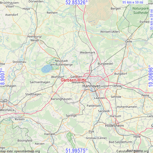
Garbsen-Mitte GPS coordinates[2]
52° 25' 35.724" North, 9° 36' 13.788" East
| Map corner | latitude | longitude |
|---|---|---|
| Upper-left | 52.85326°, | 8.9007° |
| Center: | 52.42659°, | 9.60383° |
| Lower-right: | 51.99575°, | 10.30696° |
| Map W x H: | 95.3×95.3 km | = 59.2×59.2mi |
| max Lat: | 55.01917° ⇑23.4% North |
| Garbsen-Mitte: | 52.42659° |
| min Lat: | ⇓76.6% South 47.40724° |
| min Long | Garbsen-Mitte | max Long |
| 5.92978° | 9.60383° | 14.98853° |
| W 44%⇐ | ⇒56% E |
Elevation
Elevation of Garbsen-Mitte is 52 m = 171 ft, and this is 197.1 m = 647 ft below average elevation for this country.
| Max E: |
1256 m = 4121 ft | 78.3% |
| Avg. | 249.1 m = 817 ft | |
| Garbsen-Mitte | 52 m = 171 ft | |
Min E: |
-5 m = -16 ft | 21.7% |
See also: Germany elevation on elevation.city.
Geographical zone
Garbsen-Mitte is located in North temperate zone (between Tropic of Cancer and the Arctic Circle). Distance of this North polar circle is 1571.9 km =976.7 mi to North.| Distance of | km | miles | from Garbsen-Mitte |
|---|---|---|---|
| North Pole | 4177.8 | 2596 | to North |
| Arctic Circle | 1571.9 | 976.7 | to North |
| Tropic Cancer | 3223.4 | 2002.9 | to South |
| Equator | 5829.3 | 3622.2 | to South |


Nearby cities:
15 places around Garbsen-Mitte: (largest is in red/bold)
• Auf der Horst
0.8 km =0.5 mi,  186°
186°
• Egestorf
16.7 km =10.4 mi,  200°
200°
• Garbsen
1.7 km =1.1 mi,  213°
213°
• Gehrden
12.6 km =7.8 mi,  181°
181°
• Groß Munzel
10.9 km =6.8 mi,  231°
231°
• Großgoltern
12.6 km =7.8 mi, 213°
• Hannover
10.8 km =6.7 mi,  125°
125°
• Haste
15.2 km =9.4 mi,  250°
250°
• Hemmingen
14.9 km =9.3 mi,  146°
146°
• Langenhagen
9.4 km =5.8 mi,  75°
75°
• Negenborn
14.3 km =8.9 mi,  7°
7°
• Neustadt am Rübenberge
13.1 km =8.1 mi,  311°
311°
• Ronnenberg
12.4 km =7.7 mi,  163°
163°
• Seelze
3.4 km =2.1 mi, 187°
• Wunstorf
11.4 km =7.1 mi,  268°
268°
Sources, notices
• [Note1] Compared only with cities in Germany existing in our database
• [Src1] Map data: © OpenStreetMap contributors (CC-BY-SA)
• [Src2] Other city data from geonames.org with taken over terms of usage.
• [Src3] Geographical zone / Annual Mean Temperature by Robert A. Rohde @ Wikipedia
