Stadtrandsiedlung Malchow geodata
Stadtrandsiedlung Malchow (Berlin) is a section of populated place; located in Germany in Europe/Berlin (GMT+2) time zone. With population of 1,123 people, there are 6786 cities with bigger population in this country. Compared to other cities in Germany, 78.5% of cities are located further ↓South; 95.6% of cities are located further ←West and 79.9% of cities have higher elevation than Stadtrandsiedlung Malchow. Note1
Current local time in Stadtrandsiedlung Malchow:
03:51 PM, TuesdayDifference from your time zone: hours


Stadtrandsiedlung Malchow GPS coordinates[2]
52° 34' 58.62" North, 13° 28' 41.196" East
| Map corner | latitude | longitude |
|---|---|---|
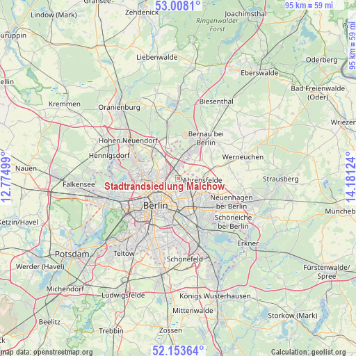
| Upper-left | 53.0081°, | 12.77499° |
| Center: | 52.58295°, | 13.47811° |
| Lower-right: | 52.15364°, | 14.18124° |
| Map W x H: | 95×95 km | = 59×59mi |
| max Lat: | 55.01917° ⇑21.5% North |
| Stadtrandsiedlung Malchow: | 52.58295° |
| min Lat: | ⇓78.5% South 47.40724° |
| min Long | Stadtrandsiedlu | max Long |
| 5.92978° | 13.47811° | 14.98853° |
| W 95.6%⇐ | ⇒4.4% E |
Elevation
Elevation of Stadtrandsiedlung Malchow is 47 m = 154 ft, and this is 202.1 m = 663 ft below average elevation for this country.
| Max E: |
1256 m = 4121 ft | 79.9% |
| Avg. | 249.1 m = 817 ft | |
| Stadtrandsiedlung Malchow | 47 m = 154 ft | |
Min E: |
-5 m = -16 ft | 20.1% |
See also: Germany elevation on elevation.city.
Geographical zone
Stadtrandsiedlung Malchow is located in North temperate zone (between Tropic of Cancer and the Arctic Circle). Distance of this North polar circle is 1554.5 km =965.9 mi to North.| Distance of | km | miles | from Stadtrandsiedlung Malchow |
|---|---|---|---|
| North Pole | 4160.4 | 2585.2 | to North |
| Arctic Circle | 1554.5 | 965.9 | to North |
| Tropic Cancer | 3240.8 | 2013.7 | to South |
| Equator | 5846.7 | 3633 | to South |


Nearby cities:
15 places around Stadtrandsiedlung Malchow: (largest is in red/bold)
• Alt-Hohenschönhausen
4.4 km =2.7 mi,  159°
159°
• Blankenburg
1.9 km =1.2 mi,  305°
305°
• Buch
5.9 km =3.7 mi,  12°
12°
• Falkenberg
4.9 km =3 mi,  109°
109°
• Fennpfuhl
6 km =3.7 mi,  183°
183°
• Französisch Buchholz
3.9 km =2.4 mi,  303°
303°
• Heinersdorf
3 km =1.9 mi,  245°
245°
• Karow
2.9 km =1.8 mi,  4°
4°
• Malchow
0.4 km =0.2 mi,  88°
88°
• Neu-Hohenschönhausen
2.9 km =1.8 mi,  127°
127°
• Niederschönhausen
5.1 km =3.2 mi,  272°
272°
• Pankow
5.4 km =3.4 mi, 253°
• Prenzlauer Berg
6.1 km =3.8 mi,  216°
216°
• Wartenberg
2.7 km =1.7 mi, 108°
• Weißensee
3.1 km =1.9 mi,  194°
194°
Sources, notices
• [Note1] Compared only with cities in Germany existing in our database
• [Src1] Map data: © OpenStreetMap contributors (CC-BY-SA)
• [Src2] Other city data from geonames.org with taken over terms of usage.
• [Src3] Geographical zone / Annual Mean Temperature by Robert A. Rohde @ Wikipedia
