Svejbæk geodata
Svejbæk (Central Jutland) is a populated place; located in Denmark in Europe/Copenhagen (GMT+2) time zone. With population of 3,743 people, there are 170 cities with bigger population in this country. Compared to other cities in Denmark, 72.5% of cities are located further ↓South; 75.7% of cities are located further →East and 64.9% of cities have lower elevation than Svejbæk. Note1


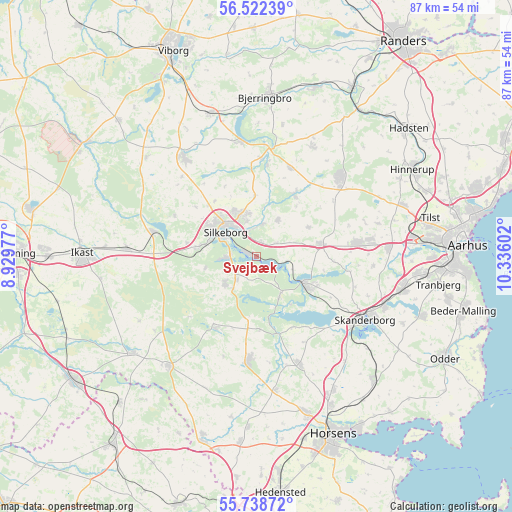
Svejbæk GPS coordinates[2]
56° 7' 57.18" North, 9° 37' 58.404" East
| Map corner | latitude | longitude |
|---|---|---|
| Upper-left | 56.52239°, | 8.92977° |
| Center: | 56.13255°, | 9.63289° |
| Lower-right: | 55.73872°, | 10.33602° |
| Map W x H: | 87.1×87.1 km | = 54.1×54.1mi |
| max Lat: | 57.72093° ⇑27.5% North |
| Svejbæk: | 56.13255° |
| min Lat: | ⇓72.5% South 54.57644° |
| min Long | Svejbæk | max Long |
| 8.12605° | 9.63289° | 15.18662° |
| W 24.3%⇐ | ⇒75.7% E |
Elevation
Elevation of Svejbæk is 32 m = 105 ft, and this is 4.7 m = 15 ft above average elevation for this country.
| Max E: |
114 m = 374 ft | 35.1% |
| Svejbæk | 32 m 105 ft | |
| Avg. | 27.3 m = 90 ft | |
Min E: |
0 m = 0 ft | 64.9% |
See also: Denmark elevation on elevation.city.
Geographical zone
Svejbæk is located in North temperate zone (between Tropic of Cancer and the Arctic Circle). Distance of this North polar circle is 1159.8 km =720.7 mi to North.| Distance of | km | miles | from Svejbæk |
|---|---|---|---|
| North Pole | 3765.7 | 2339.9 | to North |
| Arctic Circle | 1159.8 | 720.7 | to North |
| Tropic Cancer | 3635.4 | 2258.9 | to South |
| Equator | 6241.4 | 3878.2 | to South |


Nearby cities:
15 places around Svejbæk: (largest is in red/bold)
• Bording Kirkeby
24.4 km =15.2 mi,  279°
279°
• Brædstrup
18 km =11.2 mi,  184°
184°
• Framlev
23.7 km =14.7 mi,  83°
83°
• Galten
17.8 km =11.1 mi, 80°
• Hammel
19.9 km =12.4 mi,  45°
45°
• Hørning
25.6 km =15.9 mi,  101°
101°
• Isenvad
26.8 km =16.7 mi,  262°
262°
• Kjellerup
21 km =13 mi,  324°
324°
• Ry
9.4 km =5.8 mi,  119°
119°
• Sabro
26.4 km =16.4 mi,  70°
70°
• Silkeborg
6.8 km =4.2 mi,  307°
307°
• Skanderborg
21.5 km =13.4 mi, 120°
• Skovby
19.5 km =12.1 mi, 82°
• Stilling
23.4 km =14.5 mi,  109°
109°
• Virklund
4.8 km =3 mi,  269°
269°
Sources, notices
• [Note1] Compared only with cities in Denmark existing in our database
• [Src1] Map data: © OpenStreetMap contributors (CC-BY-SA)
• [Src2] Other city data from geonames.org with taken over terms of usage.
• [Src3] Geographical zone / Annual Mean Temperature by Robert A. Rohde @ Wikipedia
