Bording Kirkeby geodata
Bording Kirkeby (Central Jutland) is a populated place; located in Denmark in Europe/Copenhagen (GMT+2) time zone. With population of 2,104 people, there are 296 cities with bigger population in this country. Compared to other cities in Denmark, 75.4% of cities are located further ↓South; 85.1% of cities are located further →East and 98.2% of cities have lower elevation than Bording Kirkeby. Note1


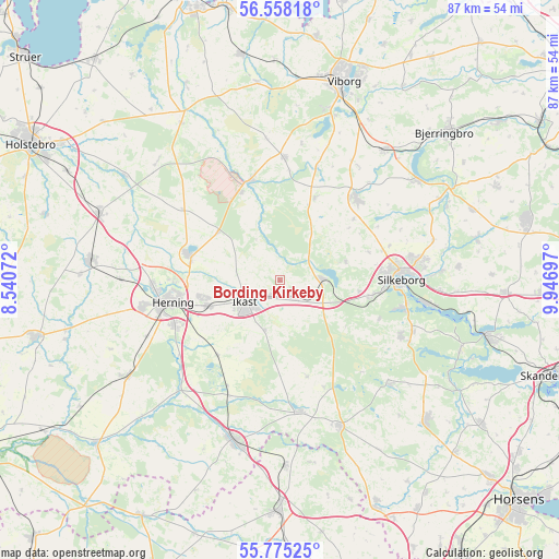
Bording Kirkeby GPS coordinates[2]
56° 10' 7.356" North, 9° 14' 37.824" East
| Map corner | latitude | longitude |
|---|---|---|
| Upper-left | 56.55818°, | 8.54072° |
| Center: | 56.16871°, | 9.24384° |
| Lower-right: | 55.77525°, | 9.94697° |
| Map W x H: | 87.1×87.1 km | = 54.1×54.1mi |
| max Lat: | 57.72093° ⇑24.6% North |
| Bording Kirkeby: | 56.16871° |
| min Lat: | ⇓75.4% South 54.57644° |
| min Long | Bording Kirkeby | max Long |
| 8.12605° | 9.24384° | 15.18662° |
| W 14.9%⇐ | ⇒85.1% E |
Elevation
Elevation of Bording Kirkeby is 87 m = 285 ft, and this is 59.7 m = 196 ft above average elevation for this country.
| Max E: |
114 m = 374 ft | 1.8% |
| Bording Kirkeby | 87 m 285 ft | |
| Avg. | 27.3 m = 90 ft | |
Min E: |
0 m = 0 ft | 98.2% |
See also: Denmark elevation on elevation.city.
Geographical zone
Bording Kirkeby is located in North temperate zone (between Tropic of Cancer and the Arctic Circle). Distance of this North polar circle is 1155.8 km =718.2 mi to North.| Distance of | km | miles | from Bording Kirkeby |
|---|---|---|---|
| North Pole | 3761.7 | 2337.4 | to North |
| Arctic Circle | 1155.8 | 718.2 | to North |
| Tropic Cancer | 3639.5 | 2261.5 | to South |
| Equator | 6245.4 | 3880.7 | to South |


Nearby cities:
15 places around Bording Kirkeby: (largest is in red/bold)
• Brande
26.1 km =16.2 mi,  196°
196°
• Gjellerup
12 km =7.5 mi,  257°
257°
• Hammerum
12 km =7.5 mi,  250°
250°
• Herning
16.9 km =10.5 mi, 257°
• Ikast
6.3 km =3.9 mi,  238°
238°
• Isenvad
8.1 km =5 mi, 197°
• Karup
16 km =9.9 mi,  343°
343°
• Kibæk
28.4 km =17.6 mi, 237°
• Kjellerup
17.6 km =10.9 mi,  42°
42°
• Lind
17.8 km =11.1 mi, 246°
• Silkeborg
18.6 km =11.6 mi,  89°
89°
• Snejbjerg
21.4 km =13.3 mi, 259°
• Sunds
14.9 km =9.3 mi,  286°
286°
• Svejbæk
24.4 km =15.2 mi,  99°
99°
• Virklund
19.7 km =12.2 mi, 101°
Sources, notices
• [Note1] Compared only with cities in Denmark existing in our database
• [Src1] Map data: © OpenStreetMap contributors (CC-BY-SA)
• [Src2] Other city data from geonames.org with taken over terms of usage.
• [Src3] Geographical zone / Annual Mean Temperature by Robert A. Rohde @ Wikipedia
