Kjellerup geodata
Kjellerup (Central Jutland) is a populated place; located in Denmark in Europe/Copenhagen (GMT+2) time zone. With population of 4,514 people, there are 142 cities with bigger population in this country. Compared to other cities in Denmark, 79.8% of cities are located further ↓South; 80.7% of cities are located further →East and 92.4% of cities have lower elevation than Kjellerup. Note1


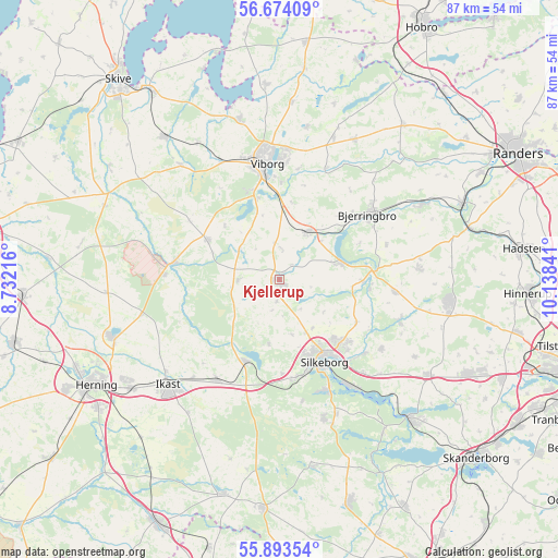
Kjellerup GPS coordinates[2]
56° 17' 8.916" North, 9° 26' 7.008" East
| Map corner | latitude | longitude |
|---|---|---|
| Upper-left | 56.67409°, | 8.73216° |
| Center: | 56.28581°, | 9.43528° |
| Lower-right: | 55.89354°, | 10.13841° |
| Map W x H: | 86.8×86.8 km | = 53.9×53.9mi |
| max Lat: | 57.72093° ⇑20.2% North |
| Kjellerup: | 56.28581° |
| min Lat: | ⇓79.8% South 54.57644° |
| min Long | Kjellerup | max Long |
| 8.12605° | 9.43528° | 15.18662° |
| W 19.3%⇐ | ⇒80.7% E |
Elevation
Elevation of Kjellerup is 63 m = 207 ft, and this is 35.7 m = 117 ft above average elevation for this country.
| Max E: |
114 m = 374 ft | 7.6% |
| Kjellerup | 63 m 207 ft | |
| Avg. | 27.3 m = 90 ft | |
Min E: |
0 m = 0 ft | 92.4% |
See also: Denmark elevation on elevation.city.
Geographical zone
Kjellerup is located in North temperate zone (between Tropic of Cancer and the Arctic Circle). Distance of this North polar circle is 1142.8 km =710.1 mi to North.| Distance of | km | miles | from Kjellerup |
|---|---|---|---|
| North Pole | 3748.7 | 2329.3 | to North |
| Arctic Circle | 1142.8 | 710.1 | to North |
| Tropic Cancer | 3652.5 | 2269.6 | to South |
| Equator | 6258.4 | 3888.8 | to South |


Nearby cities:
15 places around Kjellerup: (largest is in red/bold)
• Bjerringbro
17.3 km =10.7 mi,  53°
53°
• Bording Kirkeby
17.6 km =10.9 mi,  222°
222°
• Gjellerup
28.2 km =17.5 mi,  236°
236°
• Hammel
26.6 km =16.5 mi,  96°
96°
• Hammerum
28.7 km =17.8 mi,  233°
233°
• Ikast
23.7 km =14.7 mi, 226°
• Isenvad
25.2 km =15.7 mi,  214°
214°
• Karup
16.6 km =10.3 mi,  278°
278°
• Silkeborg
14.6 km =9.1 mi,  152°
152°
• Stoholm
28.4 km =17.6 mi,  321°
321°
• Sunds
27.5 km =17.1 mi,  251°
251°
• Svejbæk
21 km =13 mi,  144°
144°
• Ulstrup
24.9 km =15.5 mi,  62°
62°
• Viborg
18.7 km =11.6 mi,  353°
353°
• Virklund
18.6 km =11.6 mi,  156°
156°
Sources, notices
• [Note1] Compared only with cities in Denmark existing in our database
• [Src1] Map data: © OpenStreetMap contributors (CC-BY-SA)
• [Src2] Other city data from geonames.org with taken over terms of usage.
• [Src3] Geographical zone / Annual Mean Temperature by Robert A. Rohde @ Wikipedia
