Christianshavn geodata
Christianshavn (Capital Region) is a populated place; located in Denmark in Europe/Copenhagen (GMT+2) time zone. With population of 10,140 people, there are 73 cities with bigger population in this country. Compared to other cities in Denmark, 54.7% of cities are located further ↑North; 98% of cities are located further ←West and 84.5% of cities have higher elevation than Christianshavn. Note1


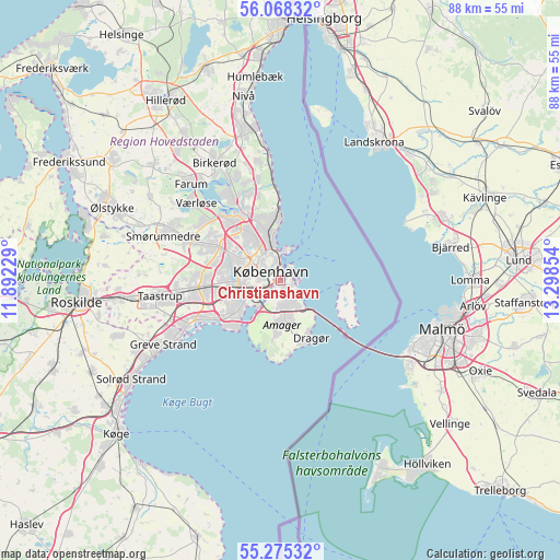
Christianshavn GPS coordinates[2]
55° 40' 25.788" North, 12° 35' 43.476" East
| Map corner | latitude | longitude |
|---|---|---|
| Upper-left | 56.06832°, | 11.89229° |
| Center: | 55.67383°, | 12.59541° |
| Lower-right: | 55.27532°, | 13.29854° |
| Map W x H: | 88.2×88.2 km | = 54.8×54.8mi |
| max Lat: | 57.72093° ⇑54.7% North |
| Christianshavn: | 55.67383° |
| min Lat: | ⇓45.3% South 54.57644° |
| min Long | Christianshavn | max Long |
| 8.12605° | 12.59541° | 15.18662° |
| W 98%⇐ | ⇒2% E |
Elevation
Elevation of Christianshavn is 7 m = 23 ft, and this is 20.3 m = 67 ft below average elevation for this country.
| Max E: |
114 m = 374 ft | 84.5% |
| Avg. | 27.3 m = 90 ft | |
| Christianshavn | 7 m = 23 ft | |
Min E: |
0 m = 0 ft | 15.5% |
See also: Denmark elevation on elevation.city.
Geographical zone
Christianshavn is located in North temperate zone (between Tropic of Cancer and the Arctic Circle). Distance of this North polar circle is 1210.8 km =752.4 mi to North.| Distance of | km | miles | from Christianshavn |
|---|---|---|---|
| North Pole | 3816.7 | 2371.6 | to North |
| Arctic Circle | 1210.8 | 752.4 | to North |
| Tropic Cancer | 3584.4 | 2227.2 | to South |
| Equator | 6190.3 | 3846.5 | to South |


Nearby cities:
15 places around Christianshavn: (largest is in red/bold)
• Brøndbyvester
12 km =7.5 mi,  254°
254°
• Buddinge
10.4 km =6.5 mi,  322°
322°
• Charlottenlund
8.8 km =5.5 mi,  351°
351°
• Copenhagen
1.9 km =1.2 mi,  277°
277°
• Dragør
10.2 km =6.3 mi,  151°
151°
• Frederiksberg
3.9 km =2.4 mi, 279°
• Glostrup
12 km =7.5 mi,  266°
266°
• Herlev
11.2 km =7 mi,  299°
299°
• Hvidovre
7.9 km =4.9 mi,  256°
256°
• Kongens Lyngby
12.2 km =7.6 mi,  331°
331°
• Rødovre
8.9 km =5.5 mi, 274°
• Tårnby
4.8 km =3 mi,  176°
176°
• Vallensbæk
14.4 km =8.9 mi, 246°
• Vanløse
6.9 km =4.3 mi, 279°
• Vibekevang
4.3 km =2.7 mi, 324°
Sources, notices
• [Note1] Compared only with cities in Denmark existing in our database
• [Src1] Map data: © OpenStreetMap contributors (CC-BY-SA)
• [Src2] Other city data from geonames.org with taken over terms of usage.
• [Src3] Geographical zone / Annual Mean Temperature by Robert A. Rohde @ Wikipedia
