Villa González geodata
Villa González (Santiago) is a populated place; located in Dominican Republic in America/Santo_Domingo (GMT-4) time zone. With population of 10,177 people, there are 67 cities with bigger population in this country. Compared to other cities in Dominican Republic, 82% of cities are located further ↓South; 58.3% of cities are located further →East and 68.2% of cities have lower elevation than Villa González. Note1
Administrative division(s):
- Level 1: Santiago
- Level 2: Villa González
- Level 3: Villa González
- Level 4: Villa González (Zona Urbana)


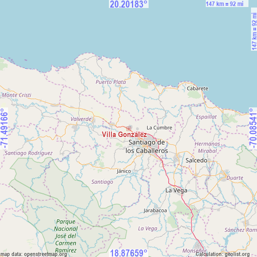
Villa González GPS coordinates[2]
19° 32' 26.052" North, 70° 47' 18.708" West
| Map corner | latitude | longitude |
|---|---|---|
| Upper-left | 20.20183°, | -71.49166° |
| Center: | 19.54057°, | -70.78853° |
| Lower-right: | 18.87659°, | -70.08541° |
| Map W x H: | 147.4×147.4 km | = 91.6×91.6mi |
| max Lat: | 19.89131° ⇑18% North |
| Villa González: | 19.54057° |
| min Lat: | ⇓82% South 17.80136° |
| min Long | Villa González | max Long |
| -71.85022° | -70.78853° | -68.40431° |
| W 41.7%⇐ | ⇒58.3% E |
Elevation
Elevation of Villa González is 164 m = 538 ft, and this is 2.3 m = 8 ft below average elevation for this country.
| Max E: |
1242 m = 4075 ft | 31.8% |
| Avg. | 166.3 m = 546 ft | |
| Villa González | 164 m = 538 ft | |
Min E: |
5 m = 16 ft | 68.2% |
See also: Dominican Republic elevation on elevation.city.
Geographical zone
Villa González is located in North Torrid zone (between Equator and Tropic of Cancer). Distance of this Northern Tropic circle is 433.2 km =269.2 mi to North.| Distance of | km | miles | from Villa González |
|---|---|---|---|
| North Pole | 7834.4 | 4868.1 | to North |
| Arctic Circle | 5228.5 | 3248.8 | to North |
| Tropic Cancer | 433.2 | 269.2 | to North |
| Equator | 2172.7 | 1350.1 | to South |


Nearby cities:
15 places around Villa González: (largest is in red/bold)
• Altamira
16.3 km =10.1 mi,  338°
338°
• Amina
21.8 km =13.5 mi,  272°
272°
• Esperanza
21.1 km =13.1 mi,  283°
283°
• Guatapanal
14 km =8.7 mi,  254°
254°
• Imbert
24.1 km =15 mi,  349°
349°
• Jicomé
20.7 km =12.9 mi,  305°
305°
• La Canela
8 km =5 mi,  201°
201°
• Licey al Medio
23.1 km =14.4 mi,  121°
121°
• Palmar Arriba
5.3 km =3.3 mi,  91°
91°
• Pedro García
15.4 km =9.6 mi,  68°
68°
• Río Grande
14.2 km =8.8 mi,  9°
9°
• Sabana Iglesia
24.6 km =15.3 mi,  172°
172°
• Santiago de los Caballeros
13.8 km =8.6 mi,  135°
135°
• Tamboril
19.6 km =12.2 mi,  108°
108°
• Villa Bisonó
9.5 km =5.9 mi,  285°
285°
Sources, notices
• [Note1] Compared only with cities in Dominican Republic existing in our database
• [Src1] Map data: © OpenStreetMap contributors (CC-BY-SA)
• [Src2] Other city data from geonames.org with taken over terms of usage.
• [Src3] Geographical zone / Annual Mean Temperature by Robert A. Rohde @ Wikipedia
