Río Grande geodata
Río Grande (Puerto Plata) is a populated place; located in Dominican Republic in America/Santo_Domingo (GMT-4) time zone. With population of 20,154 people, there are 38 cities with bigger population in this country. Compared to other cities in Dominican Republic, 91.5% of cities are located further ↓South; 56.9% of cities are located further →East and 86.3% of cities have lower elevation than Río Grande. Note1
Administrative division(s):
- Level 1: Puerto Plata
- Level 2: Altamira
- Level 3: Río Grande (D. M.).
- Level 4: Río Grande Abajo


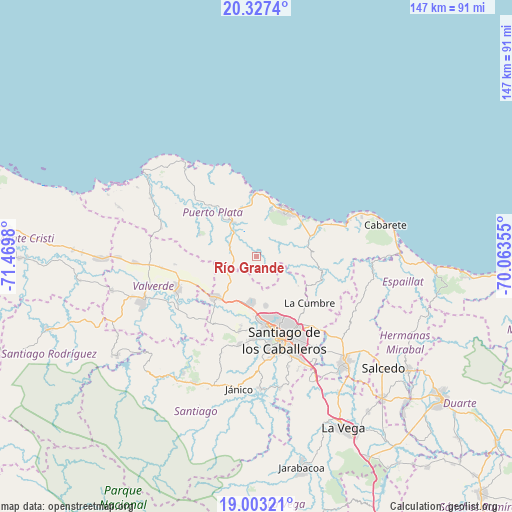
Río Grande GPS coordinates[2]
19° 40' 0.012" North, 70° 46' 0.012" West
| Map corner | latitude | longitude |
|---|---|---|
| Upper-left | 20.3274°, | -71.4698° |
| Center: | 19.66667°, | -70.76667° |
| Lower-right: | 19.00321°, | -70.06355° |
| Map W x H: | 147.2×147.2 km | = 91.5×91.5mi |
| max Lat: | 19.89131° ⇑8.5% North |
| Río Grande: | 19.66667° |
| min Lat: | ⇓91.5% South 17.80136° |
| min Long | Río Grande | max Long |
| -71.85022° | -70.76667° | -68.40431° |
| W 43.1%⇐ | ⇒56.9% E |
Elevation
Elevation of Río Grande is 397 m = 1302 ft, and this is 230.7 m = 757 ft above average elevation for this country.
| Max E: |
1242 m = 4075 ft | 13.7% |
| Río Grande | 397 m 1302 ft | |
| Avg. | 166.3 m = 546 ft | |
Min E: |
5 m = 16 ft | 86.3% |
See also: Dominican Republic elevation on elevation.city.
Geographical zone
Río Grande is located in North Torrid zone (between Equator and Tropic of Cancer). Distance of this Northern Tropic circle is 419.2 km =260.5 mi to North.| Distance of | km | miles | from Río Grande |
|---|---|---|---|
| North Pole | 7820.3 | 4859.3 | to North |
| Arctic Circle | 5214.4 | 3240.1 | to North |
| Tropic Cancer | 419.2 | 260.5 | to North |
| Equator | 2186.7 | 1358.8 | to South |


Nearby cities:
15 places around Río Grande: (largest is in red/bold)
• Altamira
8.2 km =5.1 mi,  278°
278°
• Esperanza
24.6 km =15.3 mi,  248°
248°
• Guananico
17.7 km =11 mi,  292°
292°
• Guatapanal
23.7 km =14.7 mi,  221°
221°
• Imbert
11.7 km =7.3 mi,  325°
325°
• Jicomé
19.2 km =11.9 mi,  264°
264°
• La Canela
22.1 km =13.7 mi,  193°
193°
• Monte Llano
19.1 km =11.9 mi,  66°
66°
• Palmar Arriba
14.4 km =8.9 mi,  168°
168°
• Pedro García
14.6 km =9.1 mi,  124°
124°
• Puerto Plata
16.3 km =10.1 mi,  30°
30°
• Santiago de los Caballeros
25 km =15.5 mi,  163°
163°
• Tamboril
25.9 km =16.1 mi,  141°
141°
• Villa Bisonó
16.2 km =10.1 mi, 224°
• Villa González
14.2 km =8.8 mi, 189°
Sources, notices
• [Note1] Compared only with cities in Dominican Republic existing in our database
• [Src1] Map data: © OpenStreetMap contributors (CC-BY-SA)
• [Src2] Other city data from geonames.org with taken over terms of usage.
• [Src3] Geographical zone / Annual Mean Temperature by Robert A. Rohde @ Wikipedia
