Altamira geodata
Altamira (Puerto Plata) is a populated place; located in Dominican Republic in America/Santo_Domingo (GMT-4) time zone. With population of 4,563 people, there are 120 cities with bigger population in this country. Compared to other cities in Dominican Republic, 92.4% of cities are located further ↓South; 60.7% of cities are located further →East and 82.9% of cities have lower elevation than Altamira. Note1
Administrative division(s):
- Level 1: Puerto Plata
- Level 2: Altamira
- Level 3: Altamira
- Level 4: Higüero


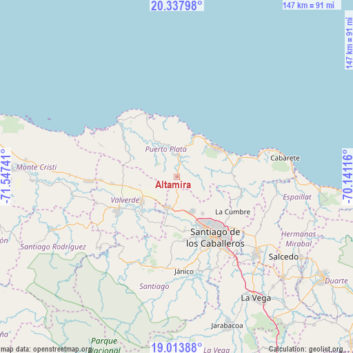
Altamira GPS coordinates[2]
19° 40' 38.28" North, 70° 50' 39.408" West
| Map corner | latitude | longitude |
|---|---|---|
| Upper-left | 20.33798°, | -71.54741° |
| Center: | 19.6773°, | -70.84428° |
| Lower-right: | 19.01388°, | -70.14116° |
| Map W x H: | 147.2×147.2 km | = 91.5×91.5mi |
| max Lat: | 19.89131° ⇑7.6% North |
| Altamira: | 19.6773° |
| min Lat: | ⇓92.4% South 17.80136° |
| min Long | Altamira | max Long |
| -71.85022° | -70.84428° | -68.40431° |
| W 39.3%⇐ | ⇒60.7% E |
Elevation
Elevation of Altamira is 317 m = 1040 ft, and this is 150.7 m = 494 ft above average elevation for this country.
| Max E: |
1242 m = 4075 ft | 17.1% |
| Altamira | 317 m 1040 ft | |
| Avg. | 166.3 m = 546 ft | |
Min E: |
5 m = 16 ft | 82.9% |
See also: Dominican Republic elevation on elevation.city.
Geographical zone
Altamira is located in North Torrid zone (between Equator and Tropic of Cancer). Distance of this Northern Tropic circle is 418 km =259.7 mi to North.| Distance of | km | miles | from Altamira |
|---|---|---|---|
| North Pole | 7819.2 | 4858.6 | to North |
| Arctic Circle | 5213.3 | 3239.4 | to North |
| Tropic Cancer | 418 | 259.7 | to North |
| Equator | 2187.9 | 1359.5 | to South |


Nearby cities:
15 places around Altamira: (largest is in red/bold)
• Amina
21.4 km =13.3 mi,  227°
227°
• Esperanza
18 km =11.2 mi,  235°
235°
• Guananico
9.9 km =6.2 mi,  303°
303°
• Guatapanal
20.4 km =12.7 mi,  201°
201°
• Imbert
8.6 km =5.3 mi,  10°
10°
• Jicomé
11.4 km =7.1 mi,  254°
254°
• La Canela
22.9 km =14.2 mi,  172°
172°
• Los Hidalgos
20.7 km =12.9 mi,  287°
287°
• Maizal
19.7 km =12.2 mi,  256°
256°
• Palmar Arriba
18.9 km =11.7 mi,  144°
144°
• Pedro García
22.2 km =13.8 mi,  115°
115°
• Puerto Plata
20.8 km =12.9 mi,  51°
51°
• Río Grande
8.2 km =5.1 mi,  98°
98°
• Villa Bisonó
13 km =8.1 mi,  194°
194°
• Villa González
16.3 km =10.1 mi,  158°
158°
Sources, notices
• [Note1] Compared only with cities in Dominican Republic existing in our database
• [Src1] Map data: © OpenStreetMap contributors (CC-BY-SA)
• [Src2] Other city data from geonames.org with taken over terms of usage.
• [Src3] Geographical zone / Annual Mean Temperature by Robert A. Rohde @ Wikipedia
