Otra Banda geodata
Otra Banda (La Altagracia) is a populated place; located in Dominican Republic in America/Santo_Domingo (GMT-4) time zone. With population of 6,071 people, there are 97 cities with bigger population in this country. Compared to other cities in Dominican Republic, 62.6% of cities are located further ↑North; 99.1% of cities are located further ←West and 62.1% of cities have lower elevation than Otra Banda. Note1
Administrative division(s):
- Level 1: La Altagracia
- Level 2: Higüey
- Level 3: La Otra Banda (D. M.).
- Level 4: La Otra Banda (Zona Urbana)


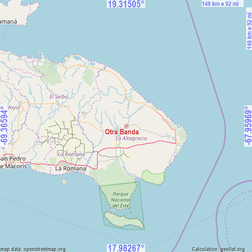
Otra Banda GPS coordinates[2]
18° 39' 0.612" North, 68° 39' 46.116" West
| Map corner | latitude | longitude |
|---|---|---|
| Upper-left | 19.31505°, | -69.36594° |
| Center: | 18.65017°, | -68.66281° |
| Lower-right: | 17.98267°, | -67.95969° |
| Map W x H: | 148.1×148.1 km | = 92×92mi |
| max Lat: | 19.89131° ⇑62.6% North |
| Otra Banda: | 18.65017° |
| min Lat: | ⇓37.4% South 17.80136° |
| min Long | Otra Banda | max Long |
| -71.85022° | -68.66281° | -68.40431° |
| W 99.1%⇐ | ⇒0.90000000000001% E |
Elevation
Elevation of Otra Banda is 113 m = 371 ft, and this is 53.3 m = 175 ft below average elevation for this country.
| Max E: |
1242 m = 4075 ft | 37.9% |
| Avg. | 166.3 m = 546 ft | |
| Otra Banda | 113 m = 371 ft | |
Min E: |
5 m = 16 ft | 62.1% |
See also: Dominican Republic elevation on elevation.city.
Geographical zone
Otra Banda is located in North Torrid zone (between Equator and Tropic of Cancer). Distance of this Northern Tropic circle is 532.2 km =330.7 mi to North.| Distance of | km | miles | from Otra Banda |
|---|---|---|---|
| North Pole | 7933.4 | 4929.6 | to North |
| Arctic Circle | 5327.5 | 3310.4 | to North |
| Tropic Cancer | 532.2 | 330.7 | to North |
| Equator | 2073.7 | 1288.5 | to South |


Nearby cities:
15 places around Otra Banda: (largest is in red/bold)
• Boca de Yuma
30.8 km =19.1 mi,  169°
169°
• El Valle
83.5 km =51.9 mi,  295°
295°
• Guayabo Dulce
65.4 km =40.6 mi,  269°
269°
• Guaymate
34 km =21.1 mi,  258°
258°
• Hato Mayor del Rey
63.8 km =39.6 mi,  281°
281°
• La Romana
41 km =25.5 mi,  232°
232°
• Miches
54.9 km =34.1 mi,  312°
312°
• Pedro Sánchez
52.6 km =32.7 mi, 296°
• Punta Cana
28.3 km =17.6 mi,  105°
105°
• Quisqueya
79.2 km =49.2 mi, 262°
• Ramón Santana
55.8 km =34.7 mi, 257°
• Salvaleón de Higüey
6.2 km =3.9 mi, 230°
• San Pedro de Macorís
71.5 km =44.4 mi,  252°
252°
• San Rafael del Yuma
24.5 km =15.2 mi,  182°
182°
• Santa Cruz de El Seibo
41.6 km =25.8 mi,  287°
287°
Sources, notices
• [Note1] Compared only with cities in Dominican Republic existing in our database
• [Src1] Map data: © OpenStreetMap contributors (CC-BY-SA)
• [Src2] Other city data from geonames.org with taken over terms of usage.
• [Src3] Geographical zone / Annual Mean Temperature by Robert A. Rohde @ Wikipedia
