El Valle geodata
El Valle (Hato Mayor) is a populated place; located in Dominican Republic in America/Santo_Domingo (GMT-4) time zone. With population of 5,666 people, there are 103 cities with bigger population in this country. Compared to other cities in Dominican Republic, 54% of cities are located further ↓South; 92.9% of cities are located further ←West and 65.4% of cities have higher elevation than El Valle. Note1
Administrative division(s):
- Level 1: Hato Mayor
- Level 2: El Valle
- Level 3: El Valle
- Level 4: El Valle (Zona Urbana)


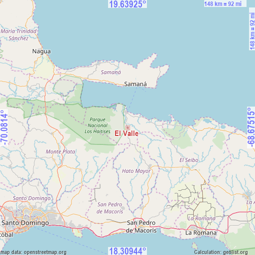
El Valle GPS coordinates[2]
18° 58' 32.412" North, 69° 22' 41.772" West
| Map corner | latitude | longitude |
|---|---|---|
| Upper-left | 19.63925°, | -70.0814° |
| Center: | 18.97567°, | -69.37827° |
| Lower-right: | 18.30944°, | -68.67515° |
| Map W x H: | 147.9×147.9 km | = 91.9×91.9mi |
| max Lat: | 19.89131° ⇑46% North |
| El Valle: | 18.97567° |
| min Lat: | ⇓54% South 17.80136° |
| min Long | El Valle | max Long |
| -71.85022° | -69.37827° | -68.40431° |
| W 92.9%⇐ | ⇒7.1% E |
Elevation
Elevation of El Valle is 42 m = 138 ft, and this is 124.3 m = 408 ft below average elevation for this country.
| Max E: |
1242 m = 4075 ft | 65.4% |
| Avg. | 166.3 m = 546 ft | |
| El Valle | 42 m = 138 ft | |
Min E: |
5 m = 16 ft | 34.6% |
See also: Dominican Republic elevation on elevation.city.
Geographical zone
El Valle is located in North Torrid zone (between Equator and Tropic of Cancer). Distance of this Northern Tropic circle is 496 km =308.2 mi to North.| Distance of | km | miles | from El Valle |
|---|---|---|---|
| North Pole | 7897.2 | 4907.1 | to North |
| Arctic Circle | 5291.3 | 3287.9 | to North |
| Tropic Cancer | 496 | 308.2 | to North |
| Equator | 2109.9 | 1311 | to South |


Nearby cities:
15 places around El Valle: (largest is in red/bold)
• Bayaguana
36.9 km =22.9 mi,  227°
227°
• El Puerto
23.3 km =14.5 mi,  203°
203°
• Gonzalo
39.3 km =24.4 mi,  266°
266°
• Guayabo Dulce
37.6 km =23.4 mi,  164°
164°
• Hato Mayor del Rey
26.9 km =16.7 mi,  151°
151°
• Las Terrenas
41.1 km =25.5 mi,  335°
335°
• Los Llanos
41.4 km =25.7 mi, 197°
• Miches
34.8 km =21.6 mi,  88°
88°
• Monte Plata
46.6 km =29 mi,  246°
246°
• Pedro Sánchez
31 km =19.3 mi,  113°
113°
• Sabana Grande de Boyá
43.8 km =27.2 mi, 265°
• Sabana de la Mar
9.4 km =5.8 mi,  353°
353°
• Samaná
25.9 km =16.1 mi,  9°
9°
• Santa Cruz de El Seibo
42.7 km =26.5 mi,  123°
123°
• Sánchez
37.4 km =23.2 mi,  318°
318°
Sources, notices
• [Note1] Compared only with cities in Dominican Republic existing in our database
• [Src1] Map data: © OpenStreetMap contributors (CC-BY-SA)
• [Src2] Other city data from geonames.org with taken over terms of usage.
• [Src3] Geographical zone / Annual Mean Temperature by Robert A. Rohde @ Wikipedia
