Guaymate geodata
Guaymate (La Romana) is a populated place; located in Dominican Republic in America/Santo_Domingo (GMT-4) time zone. With population of 6,224 people, there are 96 cities with bigger population in this country. Compared to other cities in Dominican Republic, 65.4% of cities are located further ↑North; 97.2% of cities are located further ←West and 56.4% of cities have lower elevation than Guaymate. Note1
Administrative division(s):
- Level 1: La Romana
- Level 2: Guaymate
- Level 3: Guaymate
- Level 4: Guaymate (Zona Urbana)


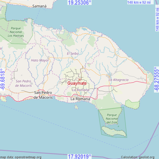
Guaymate GPS coordinates[2]
18° 35' 16.548" North, 68° 58' 43.212" West
| Map corner | latitude | longitude |
|---|---|---|
| Upper-left | 19.25306°, | -69.6818° |
| Center: | 18.58793°, | -68.97867° |
| Lower-right: | 17.92019°, | -68.27555° |
| Map W x H: | 148.2×148.2 km | = 92.1×92.1mi |
| max Lat: | 19.89131° ⇑65.4% North |
| Guaymate: | 18.58793° |
| min Lat: | ⇓34.6% South 17.80136° |
| min Long | Guaymate | max Long |
| -71.85022° | -68.97867° | -68.40431° |
| W 97.2%⇐ | ⇒2.8% E |
Elevation
Elevation of Guaymate is 88 m = 289 ft, and this is 78.3 m = 257 ft below average elevation for this country.
| Max E: |
1242 m = 4075 ft | 43.6% |
| Avg. | 166.3 m = 546 ft | |
| Guaymate | 88 m = 289 ft | |
Min E: |
5 m = 16 ft | 56.4% |
See also: Dominican Republic elevation on elevation.city.
Geographical zone
Guaymate is located in North Torrid zone (between Equator and Tropic of Cancer). Distance of this Northern Tropic circle is 539.1 km =335 mi to North.| Distance of | km | miles | from Guaymate |
|---|---|---|---|
| North Pole | 7940.3 | 4933.9 | to North |
| Arctic Circle | 5334.4 | 3314.6 | to North |
| Tropic Cancer | 539.1 | 335 | to North |
| Equator | 2066.8 | 1284.2 | to South |


Nearby cities:
15 places around Guaymate: (largest is in red/bold)
• Boca de Yuma
45.4 km =28.2 mi,  120°
120°
• El Puerto
55.8 km =34.7 mi,  292°
292°
• Guayabo Dulce
32.8 km =20.4 mi,  282°
282°
• Hato Mayor del Rey
35.2 km =21.9 mi,  303°
303°
• La Romana
17.9 km =11.1 mi,  178°
178°
• Los Llanos
54.6 km =33.9 mi,  273°
273°
• Miches
44.6 km =27.7 mi,  350°
350°
• Otra Banda
34 km =21.1 mi,  78°
78°
• Pedro Sánchez
33.6 km =20.9 mi,  335°
335°
• Quisqueya
45.4 km =28.2 mi, 265°
• Ramón Santana
21.8 km =13.5 mi,  256°
256°
• Salvaleón de Higüey
28.7 km =17.8 mi, 83°
• San Pedro de Macorís
37.8 km =23.5 mi,  246°
246°
• San Rafael del Yuma
36.6 km =22.7 mi, 118°
• Santa Cruz de El Seibo
20.7 km =12.9 mi, 342°
Sources, notices
• [Note1] Compared only with cities in Dominican Republic existing in our database
• [Src1] Map data: © OpenStreetMap contributors (CC-BY-SA)
• [Src2] Other city data from geonames.org with taken over terms of usage.
• [Src3] Geographical zone / Annual Mean Temperature by Robert A. Rohde @ Wikipedia
