Chorfa geodata
Chorfa (Bouira) is a populated place; located in Algeria in Africa/Algiers (GMT+1) time zone. With population of 20,556 people, there are 226 cities with bigger population in this country. Compared to other cities in Algeria, 61.6% of cities are located further ↓South; 63.6% of cities are located further ←West and 52.7% of cities have lower elevation than Chorfa. Note1


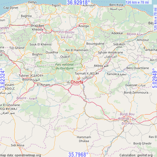
Chorfa GPS coordinates[2]
36° 21' 54.18" North, 4° 19' 34.896" East
| Map corner | latitude | longitude |
|---|---|---|
| Upper-left | 36.92918°, | 3.62324° |
| Center: | 36.36505°, | 4.32636° |
| Lower-right: | 35.7968°, | 5.02949° |
| Map W x H: | 125.9×125.9 km | = 78.2×78.2mi |
| max Lat: | 36.92917° ⇑38.4% North |
| Chorfa: | 36.36505° |
| min Lat: | ⇓61.6% South 22.785° |
| min Long | Chorfa | max Long |
| -8.14743° | 4.32636° | 8.46667° |
| W 63.6%⇐ | ⇒36.4% E |
Elevation
Elevation of Chorfa is 342 m = 1122 ft, and this is 96.5 m = 317 ft below average elevation for this country.
| Max E: |
1392 m = 4567 ft | 47.3% |
| Avg. | 438.5 m = 1439 ft | |
| Chorfa | 342 m = 1122 ft | |
Min E: |
5 m = 16 ft | 52.7% |
See also: Algeria elevation on elevation.city.
Geographical zone
Chorfa is located in North temperate zone (between Tropic of Cancer and the Arctic Circle). Distance of this Northern Tropic circle is 1437.5 km =893.2 mi to South.| Distance of | km | miles | from Chorfa |
|---|---|---|---|
| North Pole | 5963.6 | 3705.6 | to North |
| Arctic Circle | 3357.8 | 2086.4 | to North |
| Tropic Cancer | 1437.5 | 893.2 | to South |
| Equator | 4043.4 | 2512.5 | to South |


Nearby cities:
15 places around Chorfa: (largest is in red/bold)
• Ait Yahia
24.9 km =15.5 mi,  1°
1°
• Akbou
21.3 km =13.2 mi,  61°
61°
• Azazga
42.4 km =26.3 mi,  5°
5°
• Beni Douala
35.7 km =22.2 mi,  322°
322°
• Boghni
38.8 km =24.1 mi,  300°
300°
• Bouïra
38 km =23.6 mi,  271°
271°
• Chemini
36.8 km =22.9 mi,  44°
44°
• Ighram
19.4 km =12.1 mi, 55°
• L’Arbaa Naït Irathen
31.7 km =19.7 mi,  338°
338°
• Mansourah
32.9 km =20.4 mi,  159°
159°
• Mekla
35.7 km =22.2 mi,  350°
350°
• Seddouk
38 km =23.6 mi, 57°
• Tizi Rached
36.2 km =22.5 mi, 340°
• Tizi-n-Tleta
31.4 km =19.5 mi,  309°
309°
• ’Aïn el Hammam
22.3 km =13.9 mi,  355°
355°
Sources, notices
• [Note1] Compared only with cities in Algeria existing in our database
• [Src1] Map data: © OpenStreetMap contributors (CC-BY-SA)
• [Src2] Other city data from geonames.org with taken over terms of usage.
• [Src3] Geographical zone / Annual Mean Temperature by Robert A. Rohde @ Wikipedia
