Bouïra geodata
Bouïra (Bouira) is a seat of a first-order administrative division; located in Algeria in Africa/Algiers (GMT+1) time zone. With population of 52,500 people, there are 93 cities with bigger population in this country. Compared to other cities in Algeria, 62% of cities are located further ↓South; 56.2% of cities are located further ←West and 61.2% of cities have lower elevation than Bouïra. Note1


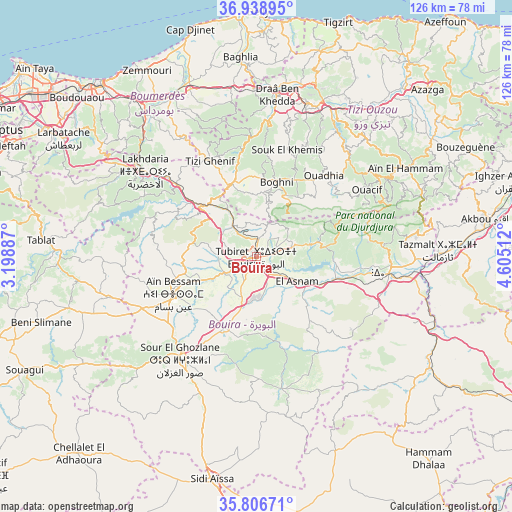
Bouïra GPS coordinates[2]
36° 22' 29.604" North, 3° 54' 7.2" East
| Map corner | latitude | longitude |
|---|---|---|
| Upper-left | 36.93895°, | 3.19887° |
| Center: | 36.37489°, | 3.902° |
| Lower-right: | 35.80671°, | 4.60512° |
| Map W x H: | 125.9×125.9 km | = 78.2×78.2mi |
| max Lat: | 36.92917° ⇑38% North |
| Bouïra: | 36.37489° |
| min Lat: | ⇓62% South 22.785° |
| min Long | Bouïra | max Long |
| -8.14743° | 3.902° | 8.46667° |
| W 56.2%⇐ | ⇒43.8% E |
Elevation
Elevation of Bouïra is 519 m = 1703 ft, and this is 80.5 m = 264 ft above average elevation for this country.
| Max E: |
1392 m = 4567 ft | 38.8% |
| Bouïra | 519 m 1703 ft | |
| Avg. | 438.5 m = 1439 ft | |
Min E: |
5 m = 16 ft | 61.2% |
See also: Bouïra elevation on elevation.city.
Geographical zone
Bouïra is located in North temperate zone (between Tropic of Cancer and the Arctic Circle). Distance of this Northern Tropic circle is 1438.6 km =893.9 mi to South.| Distance of | km | miles | from Bouïra |
|---|---|---|---|
| North Pole | 5962.6 | 3705 | to North |
| Arctic Circle | 3356.7 | 2085.8 | to North |
| Tropic Cancer | 1438.6 | 893.9 | to South |
| Equator | 4044.5 | 2513.1 | to South |


Nearby cities:
15 places around Bouïra: (largest is in red/bold)
• Aïn Bessem
22.4 km =13.9 mi,  246°
246°
• Beni Douala
31.6 km =19.6 mi,  30°
30°
• Boghni
19.2 km =11.9 mi,  13°
13°
• Chabet el Ameur
34.5 km =21.4 mi,  327°
327°
• Chorfa
38 km =23.6 mi,  91°
91°
• Draa Ben Khedda
40.3 km =25 mi, 7°
• Draa el Mizan
19 km =11.8 mi,  341°
341°
• Lakhdaria
34.7 km =21.6 mi,  307°
307°
• L’Arbaa Naït Irathen
38.9 km =24.2 mi,  42°
42°
• Sour el Ghozlane
31.6 km =19.6 mi,  216°
216°
• Tadmaït
41.1 km =25.5 mi,  359°
359°
• Tirmitine
31.8 km =19.8 mi, 12°
• Tizi Gheniff
26.3 km =16.3 mi, 334°
• Tizi Ouzou
39.6 km =24.6 mi,  18°
18°
• Tizi-n-Tleta
23.5 km =14.6 mi, 36°
Sources, notices
• [Note1] Compared only with cities in Algeria existing in our database
• [Src1] Map data: © OpenStreetMap contributors (CC-BY-SA)
• [Src2] Other city data from geonames.org with taken over terms of usage.
• [Src3] Geographical zone / Annual Mean Temperature by Robert A. Rohde @ Wikipedia
