Pärnu-Jaagupi geodata
Pärnu-Jaagupi (Pärnumaa) is a populated place; located in Estonia in Europe/Tallinn (GMT+3) time zone. With population of 1,341 people, there are 68 cities with bigger population in this country. Compared to other cities in Estonia, 60.5% of cities are located further ↑North; 80% of cities are located further →East and 75.8% of cities have higher elevation than Pärnu-Jaagupi. Note1
Administrative division(s):
- Level 1: Pärnumaa
- Level 2: Põhja-Pärnumaa vald
- Level 3: Pärnu-Jaagupi alev


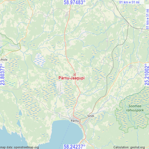
Pärnu-Jaagupi GPS coordinates[2]
58° 36' 37.872" North, 24° 30' 24.804" East
| Map corner | latitude | longitude |
|---|---|---|
| Upper-left | 58.97483°, | 23.80377° |
| Center: | 58.61052°, | 24.50689° |
| Lower-right: | 58.24237°, | 25.21002° |
| Map W x H: | 81.4×81.4 km | = 50.6×50.6mi |
| max Lat: | 59.57639° ⇑60.5% North |
| Pärnu-Jaagupi: | 58.61052° |
| min Lat: | ⇓39.5% South 57.72778° |
| min Long | Pärnu-Jaagupi | max Long |
| 22.24646° | 24.50689° | 28.19028° |
| W 20%⇐ | ⇒80% E |
Elevation
Elevation of Pärnu-Jaagupi is 31 m = 102 ft, and this is 22.2 m = 73 ft below average elevation for this country.
| Max E: |
141 m = 463 ft | 75.8% |
| Avg. | 53.2 m = 175 ft | |
| Pärnu-Jaagupi | 31 m = 102 ft | |
Min E: |
6 m = 20 ft | 24.2% |
See also: Estonia elevation on elevation.city.
Geographical zone
Pärnu-Jaagupi is located in North temperate zone (between Tropic of Cancer and the Arctic Circle). Distance of this North polar circle is 884.3 km =549.5 mi to North.| Distance of | km | miles | from Pärnu-Jaagupi |
|---|---|---|---|
| North Pole | 3490.2 | 2168.7 | to North |
| Arctic Circle | 884.3 | 549.5 | to North |
| Tropic Cancer | 3911 | 2430.2 | to South |
| Equator | 6516.9 | 4049.4 | to South |


Nearby cities:
15 places around Pärnu-Jaagupi: (largest is in red/bold)
• Audru
23.7 km =14.7 mi,  198°
198°
• Järvakandi
26.3 km =16.3 mi,  44°
44°
• Lavassaare
13 km =8.1 mi,  211°
211°
• Märjamaa
32.9 km =20.4 mi,  352°
352°
• Orgita
35.7 km =22.2 mi, 352°
• Paikuse
26.8 km =16.7 mi,  163°
163°
• Pärnu
25 km =15.5 mi,  181°
181°
• Sauga
20.4 km =12.7 mi, 181°
• Sindi
25.1 km =15.6 mi, 158°
• Tootsi
16.9 km =10.5 mi,  102°
102°
• Tori
23.5 km =14.6 mi,  128°
128°
• Uulu
36.6 km =22.7 mi,  172°
172°
• Vana-Vigala
22.2 km =13.8 mi,  322°
322°
• Vändra
30.9 km =19.2 mi,  82°
82°
• Võiste
16.1 km =10 mi, 184°
Sources, notices
• [Note1] Compared only with cities in Estonia existing in our database
• [Src1] Map data: © OpenStreetMap contributors (CC-BY-SA)
• [Src2] Other city data from geonames.org with taken over terms of usage.
• [Src3] Geographical zone / Annual Mean Temperature by Robert A. Rohde @ Wikipedia
