Vana-Vigala geodata
Vana-Vigala (Raplamaa) is a populated place; located in Estonia in Europe/Tallinn (GMT+3) time zone. With population of 572 people, there are 145 cities with bigger population in this country. Compared to other cities in Estonia, 54.2% of cities are located further ↑North; 87.4% of cities are located further →East and 77.4% of cities have higher elevation than Vana-Vigala. Note1


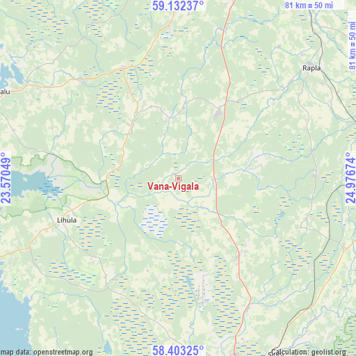
Vana-Vigala GPS coordinates[2]
58° 46' 10.992" North, 24° 16' 24.996" East
| Map corner | latitude | longitude |
|---|---|---|
| Upper-left | 59.13237°, | 23.57049° |
| Center: | 58.76972°, | 24.27361° |
| Lower-right: | 58.40325°, | 24.97674° |
| Map W x H: | 81.1×81.1 km | = 50.4×50.4mi |
| max Lat: | 59.57639° ⇑54.2% North |
| Vana-Vigala: | 58.76972° |
| min Lat: | ⇓45.8% South 57.72778° |
| min Long | Vana-Vigala | max Long |
| 22.24646° | 24.27361° | 28.19028° |
| W 12.6%⇐ | ⇒87.4% E |
Elevation
Elevation of Vana-Vigala is 28 m = 92 ft, and this is 25.2 m = 83 ft below average elevation for this country.
| Max E: |
141 m = 463 ft | 77.4% |
| Avg. | 53.2 m = 175 ft | |
| Vana-Vigala | 28 m = 92 ft | |
Min E: |
6 m = 20 ft | 22.6% |
See also: Estonia elevation on elevation.city.
Geographical zone
Vana-Vigala is located in North temperate zone (between Tropic of Cancer and the Arctic Circle). Distance of this North polar circle is 866.6 km =538.5 mi to North.| Distance of | km | miles | from Vana-Vigala |
|---|---|---|---|
| North Pole | 3472.5 | 2157.7 | to North |
| Arctic Circle | 866.6 | 538.5 | to North |
| Tropic Cancer | 3928.7 | 2441.2 | to South |
| Equator | 6534.6 | 4060.4 | to South |


Nearby cities:
15 places around Vana-Vigala: (largest is in red/bold)
• Järvakandi
31.8 km =19.8 mi,  88°
88°
• Kaerepere
39.3 km =24.4 mi,  56°
56°
• Kehtna
39.1 km =24.3 mi, 62°
• Lavassaare
29.5 km =18.3 mi,  166°
166°
• Lihula
26.6 km =16.5 mi,  248°
248°
• Märjamaa
17.4 km =10.8 mi,  31°
31°
• Orgita
19.8 km =12.3 mi, 26°
• Palivere
30.8 km =19.1 mi,  316°
316°
• Pärnu-Jaagupi
22.2 km =13.8 mi,  142°
142°
• Riisipere
38.4 km =23.9 mi,  3°
3°
• Risti
34.2 km =21.3 mi,  227°
227°
• Taebla
36.3 km =22.6 mi,  304°
304°
• Tootsi
36.8 km =22.9 mi,  125°
125°
• Turba
35 km =21.7 mi,  355°
355°
• Võiste
35.8 km =22.2 mi,  160°
160°
Sources, notices
• [Note1] Compared only with cities in Estonia existing in our database
• [Src1] Map data: © OpenStreetMap contributors (CC-BY-SA)
• [Src2] Other city data from geonames.org with taken over terms of usage.
• [Src3] Geographical zone / Annual Mean Temperature by Robert A. Rohde @ Wikipedia
