Olustvere geodata
Olustvere (Viljandimaa) is a populated place; located in Estonia in Europe/Tallinn (GMT+3) time zone. With population of 647 people, there are 128 cities with bigger population in this country. Compared to other cities in Estonia, 64.7% of cities are located further ↑North; 52.6% of cities are located further ←West and 85.8% of cities have lower elevation than Olustvere. Note1
Administrative division(s):
- Level 1: Viljandimaa
- Level 2: Põhja-Sakala vald
- Level 3: Olustvere alevik


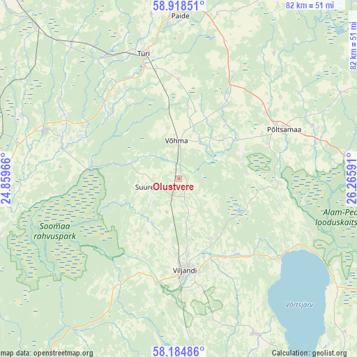
Olustvere GPS coordinates[2]
58° 33' 12.996" North, 25° 33' 46.008" East
| Map corner | latitude | longitude |
|---|---|---|
| Upper-left | 58.91851°, | 24.85966° |
| Center: | 58.55361°, | 25.56278° |
| Lower-right: | 58.18486°, | 26.26591° |
| Map W x H: | 81.6×81.6 km | = 50.7×50.7mi |
| max Lat: | 59.57639° ⇑64.7% North |
| Olustvere: | 58.55361° |
| min Lat: | ⇓35.3% South 57.72778° |
| min Long | Olustvere | max Long |
| 22.24646° | 25.56278° | 28.19028° |
| W 52.6%⇐ | ⇒47.4% E |
Elevation
Elevation of Olustvere is 83 m = 272 ft, and this is 29.8 m = 98 ft above average elevation for this country.
| Max E: |
141 m = 463 ft | 14.2% |
| Olustvere | 83 m 272 ft | |
| Avg. | 53.2 m = 175 ft | |
Min E: |
6 m = 20 ft | 85.8% |
See also: Estonia elevation on elevation.city.
Geographical zone
Olustvere is located in North temperate zone (between Tropic of Cancer and the Arctic Circle). Distance of this North polar circle is 890.6 km =553.4 mi to North.| Distance of | km | miles | from Olustvere |
|---|---|---|---|
| North Pole | 3496.5 | 2172.6 | to North |
| Arctic Circle | 890.6 | 553.4 | to North |
| Tropic Cancer | 3904.6 | 2426.2 | to South |
| Equator | 6510.6 | 4045.5 | to South |


Nearby cities:
15 places around Olustvere: (largest is in red/bold)
• Adavere
25.8 km =16 mi,  48°
48°
• Paide
36.9 km =22.9 mi,  359°
359°
• Põltsamaa
26.1 km =16.2 mi,  65°
65°
• Ramsi
27.6 km =17.1 mi,  183°
183°
• Suure-Jaani
5.7 km =3.5 mi,  250°
250°
• Särevere
27.4 km =17 mi,  343°
343°
• Türi
29.3 km =18.2 mi,  345°
345°
• Türi-Alliku
29.8 km =18.5 mi, 347°
• Vana-Võidu
18.9 km =11.7 mi,  163°
163°
• Viiratsi
22 km =13.7 mi,  168°
168°
• Viljandi
21.2 km =13.2 mi, 175°
• Vyatsa
37.5 km =23.3 mi, 349°
• Vändra
32.3 km =20.1 mi,  288°
288°
• Võhma
8.4 km =5.2 mi, 354°
• Võisiku
22.3 km =13.9 mi, 68°
Sources, notices
• [Note1] Compared only with cities in Estonia existing in our database
• [Src1] Map data: © OpenStreetMap contributors (CC-BY-SA)
• [Src2] Other city data from geonames.org with taken over terms of usage.
• [Src3] Geographical zone / Annual Mean Temperature by Robert A. Rohde @ Wikipedia
