Särevere geodata
Särevere (Järvamaa) is a populated place; located in Estonia in Europe/Tallinn (GMT+3) time zone. With population of 1,035 people, there are 88 cities with bigger population in this country. Compared to other cities in Estonia, 53.2% of cities are located further ↑North; 52.1% of cities are located further →East and 63.2% of cities have lower elevation than Särevere. Note1


Särevere GPS coordinates[2]
58° 47' 24" North, 25° 25' 41.016" East
| Map corner | latitude | longitude |
|---|---|---|
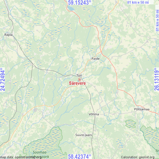
| Upper-left | 59.15243°, | 24.72494° |
| Center: | 58.79°, | 25.42806° |
| Lower-right: | 58.42374°, | 26.13119° |
| Map W x H: | 81×81 km | = 50.3×50.3mi |
| max Lat: | 59.57639° ⇑53.2% North |
| Särevere: | 58.79° |
| min Lat: | ⇓46.8% South 57.72778° |
| min Long | Särevere | max Long |
| 22.24646° | 25.42806° | 28.19028° |
| W 47.9%⇐ | ⇒52.1% E |
Elevation
Elevation of Särevere is 62 m = 203 ft, and this is 8.8 m = 29 ft above average elevation for this country.
| Max E: |
141 m = 463 ft | 36.8% |
| Särevere | 62 m 203 ft | |
| Avg. | 53.2 m = 175 ft | |
Min E: |
6 m = 20 ft | 63.2% |
See also: Estonia elevation on elevation.city.
Geographical zone
Särevere is located in North temperate zone (between Tropic of Cancer and the Arctic Circle). Distance of this North polar circle is 864.3 km =537.1 mi to North.| Distance of | km | miles | from Särevere |
|---|---|---|---|
| North Pole | 3470.2 | 2156.3 | to North |
| Arctic Circle | 864.3 | 537.1 | to North |
| Tropic Cancer | 3930.9 | 2442.5 | to South |
| Equator | 6536.8 | 4061.8 | to South |


Nearby cities:
15 places around Särevere: (largest is in red/bold)
• Adavere
28.7 km =17.8 mi,  108°
108°
• Ardu
34.7 km =21.6 mi,  354°
354°
• Järva-Jaani
38.2 km =23.7 mi,  43°
43°
• Järvakandi
34.7 km =21.6 mi,  267°
267°
• Kehtna
35.3 km =21.9 mi,  296°
296°
• Olustvere
27.4 km =17 mi,  163°
163°
• Paide
13 km =8.1 mi,  34°
34°
• Põltsamaa
34.9 km =21.7 mi,  116°
116°
• Suure-Jaani
28.3 km =17.6 mi,  175°
175°
• Türi
2.1 km =1.3 mi,  7°
7°
• Türi-Alliku
3.2 km =2 mi, 27°
• Vyatsa
10.7 km =6.6 mi, 5°
• Vändra
27.6 km =17.1 mi,  235°
235°
• Võhma
19.3 km =12 mi, 158°
• Võisiku
33.6 km =20.9 mi, 122°
Sources, notices
• [Note1] Compared only with cities in Estonia existing in our database
• [Src1] Map data: © OpenStreetMap contributors (CC-BY-SA)
• [Src2] Other city data from geonames.org with taken over terms of usage.
• [Src3] Geographical zone / Annual Mean Temperature by Robert A. Rohde @ Wikipedia
