Shibīn al Kawm geodata
Shibīn al Kawm (Monufia) is a seat of a first-order administrative division; located in Egypt in Africa/Cairo (GMT+2) time zone. With population of 186,345 people, there are 23 cities with bigger population in this country. Compared to other cities in Egypt, 59.4% of cities are located further ↓South; 67.4% of cities are located further →East and 59.4% of cities have lower elevation than Shibīn al Kawm. Note1


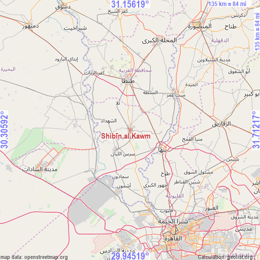
Shibīn al Kawm GPS coordinates[2]
30° 33' 9.288" North, 31° 0' 32.544" East
| Map corner | latitude | longitude |
|---|---|---|
| Upper-left | 31.15619°, | 30.30592° |
| Center: | 30.55258°, | 31.00904° |
| Lower-right: | 29.94519°, | 31.71217° |
| Map W x H: | 134.7×134.7 km | = 83.7×83.7mi |
| max Lat: | 31.5084° ⇑40.6% North |
| Shibīn al Kawm: | 30.55258° |
| min Lat: | ⇓59.4% South 22.3457° |
| min Long | Shibīn al Kawm | max Long |
| 25.51965° | 31.00904° | 34.89572° |
| W 32.6%⇐ | ⇒67.4% E |
Elevation
Elevation of Shibīn al Kawm is 23 m = 75 ft, and this is 20.5 m = 67 ft below average elevation for this country.
| Max E: |
1565 m = 5135 ft | 40.6% |
| Avg. | 43.5 m = 143 ft | |
| Shibīn al Kawm | 23 m = 75 ft | |
Min E: |
-15 m = -49 ft | 59.4% |
See also: Shibīn al Kawm elevation on elevation.city.
Geographical zone
Shibīn al Kawm is located in North temperate zone (between Tropic of Cancer and the Arctic Circle). Distance of this Northern Tropic circle is 791.2 km =491.6 mi to South.| Distance of | km | miles | from Shibīn al Kawm |
|---|---|---|---|
| North Pole | 6609.9 | 4107.2 | to North |
| Arctic Circle | 4004 | 2488 | to North |
| Tropic Cancer | 791.2 | 491.6 | to South |
| Equator | 3397.1 | 2110.9 | to South |


Nearby cities:
15 places around Shibīn al Kawm: (largest is in red/bold)
• Al Bājūr
13.8 km =8.6 mi,  168°
168°
• Al Qanāţir al Khayrīyah
41.8 km =26 mi,  162°
162°
• Ash Shuhadā’
11.6 km =7.2 mi,  295°
295°
• Ashmūn
28.6 km =17.8 mi,  186°
186°
• Banhā
19.7 km =12.2 mi,  121°
121°
• Kafr az Zayyāt
35.4 km =22 mi,  328°
328°
• Kawm Ḩamādah
37.6 km =23.4 mi,  308°
308°
• Mashtūl as Sūq
41.3 km =25.7 mi, 121°
• Munūf
12.1 km =7.5 mi,  217°
217°
• Quwaysinā
14.3 km =8.9 mi,  84°
84°
• Shibīn al Qanāṭir
40 km =24.9 mi,  131°
131°
• Talā
15.5 km =9.6 mi,  336°
336°
• Tanda
26.2 km =16.3 mi,  358°
358°
• Toukh
28.7 km =17.8 mi,  140°
140°
• Zefta
28.8 km =17.9 mi,  51°
51°
Sources, notices
• [Note1] Compared only with cities in Egypt existing in our database
• [Src1] Map data: © OpenStreetMap contributors (CC-BY-SA)
• [Src2] Other city data from geonames.org with taken over terms of usage.
• [Src3] Geographical zone / Annual Mean Temperature by Robert A. Rohde @ Wikipedia
