Mashtūl as Sūq geodata
Mashtūl as Sūq (Sharqia) is a populated place; located in Egypt in Africa/Cairo (GMT+2) time zone. With population of 45,798 people, there are 91 cities with bigger population in this country. Compared to other cities in Egypt, 54.3% of cities are located further ↓South; 53.6% of cities are located further ←West and 61.6% of cities have higher elevation than Mashtūl as Sūq. Note1


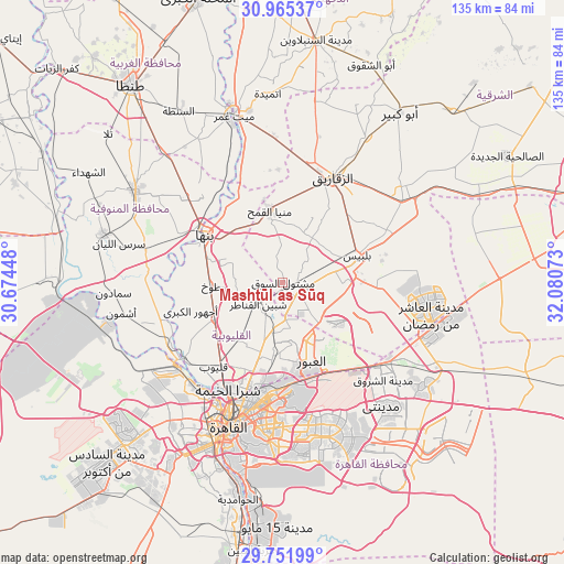
Mashtūl as Sūq GPS coordinates[2]
30° 21' 38.016" North, 31° 22' 39.36" East
| Map corner | latitude | longitude |
|---|---|---|
| Upper-left | 30.96537°, | 30.67448° |
| Center: | 30.36056°, | 31.3776° |
| Lower-right: | 29.75199°, | 32.08073° |
| Map W x H: | 134.9×134.9 km | = 83.8×83.8mi |
| max Lat: | 31.5084° ⇑45.7% North |
| Mashtūl as Sūq: | 30.36056° |
| min Lat: | ⇓54.3% South 22.3457° |
| min Long | Mashtūl as Sū | max Long |
| 25.51965° | 31.3776° | 34.89572° |
| W 53.6%⇐ | ⇒46.4% E |
Elevation
Elevation of Mashtūl as Sūq is 15 m = 49 ft, and this is 28.5 m = 94 ft below average elevation for this country.
| Max E: |
1565 m = 5135 ft | 61.6% |
| Avg. | 43.5 m = 143 ft | |
| Mashtūl as Sūq | 15 m = 49 ft | |
Min E: |
-15 m = -49 ft | 38.4% |
See also: Mashtūl as Sūq elevation on elevation.city.
Geographical zone
Mashtūl as Sūq is located in North temperate zone (between Tropic of Cancer and the Arctic Circle). Distance of this Northern Tropic circle is 769.9 km =478.4 mi to South.| Distance of | km | miles | from Mashtūl as Sūq |
|---|---|---|---|
| North Pole | 6631.3 | 4120.5 | to North |
| Arctic Circle | 4025.4 | 2501.3 | to North |
| Tropic Cancer | 769.9 | 478.4 | to South |
| Equator | 3375.8 | 2097.6 | to South |


Nearby cities:
15 places around Mashtūl as Sūq: (largest is in red/bold)
• Al Bājūr
33.6 km =20.9 mi,  283°
283°
• Al Khānkah
16.7 km =10.4 mi,  183°
183°
• Al Qanāyāt
29.9 km =18.6 mi,  15°
15°
• Al Qanāţir al Khayrīyah
29.7 km =18.5 mi,  231°
231°
• Ashmūn
39.1 km =24.3 mi,  259°
259°
• Awsīm
35.2 km =21.9 mi,  221°
221°
• Banhā
21.6 km =13.4 mi,  300°
300°
• Bilbays
18.9 km =11.7 mi,  69°
69°
• Cairo
35.3 km =21.9 mi,  200°
200°
• New Cairo
37.8 km =23.5 mi,  166°
166°
• Qalyūb
26.1 km =16.2 mi, 219°
• Quwaysinā
31 km =19.3 mi,  317°
317°
• Shibīn al Qanāṭir
7.7 km =4.8 mi, 225°
• Toukh
17 km =10.6 mi,  267°
267°
• Zagazig
27.9 km =17.3 mi,  25°
25°
Sources, notices
• [Note1] Compared only with cities in Egypt existing in our database
• [Src1] Map data: © OpenStreetMap contributors (CC-BY-SA)
• [Src2] Other city data from geonames.org with taken over terms of usage.
• [Src3] Geographical zone / Annual Mean Temperature by Robert A. Rohde @ Wikipedia
