Zefta geodata
Zefta (Gharbia) is a populated place; located in Egypt in Africa/Cairo (GMT+2) time zone. With population of 92,667 people, there are 41 cities with bigger population in this country. Compared to other cities in Egypt, 65.9% of cities are located further ↓South; 54.3% of cities are located further →East and 55.1% of cities have higher elevation than Zefta. Note1


Zefta GPS coordinates[2]
30° 42' 51.12" North, 31° 14' 39.3" East
| Map corner | latitude | longitude |
|---|---|---|
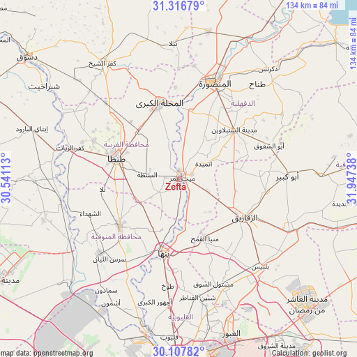
| Upper-left | 31.31679°, | 30.54113° |
| Center: | 30.7142°, | 31.24425° |
| Lower-right: | 30.10782°, | 31.94738° |
| Map W x H: | 134.4×134.4 km | = 83.5×83.5mi |
| max Lat: | 31.5084° ⇑34.1% North |
| Zefta: | 30.7142° |
| min Lat: | ⇓65.9% South 22.3457° |
| min Long | Zefta | max Long |
| 25.51965° | 31.24425° | 34.89572° |
| W 45.7%⇐ | ⇒54.3% E |
Elevation
Elevation of Zefta is 16 m = 52 ft, and this is 27.5 m = 90 ft below average elevation for this country.
| Max E: |
1565 m = 5135 ft | 55.1% |
| Avg. | 43.5 m = 143 ft | |
| Zefta | 16 m = 52 ft | |
Min E: |
-15 m = -49 ft | 44.9% |
See also: Zefta elevation on elevation.city.
Geographical zone
Zefta is located in North temperate zone (between Tropic of Cancer and the Arctic Circle). Distance of this Northern Tropic circle is 809.2 km =502.8 mi to South.| Distance of | km | miles | from Zefta |
|---|---|---|---|
| North Pole | 6592 | 4096.1 | to North |
| Arctic Circle | 3986.1 | 2476.8 | to North |
| Tropic Cancer | 809.2 | 502.8 | to South |
| Equator | 3415.1 | 2122 | to South |


Nearby cities:
15 places around Zefta: (largest is in red/bold)
• Ajā
25.7 km =16 mi,  9°
9°
• Al Bājūr
37.3 km =23.2 mi,  212°
212°
• Al Ibrāhīmīyah
30.5 km =19 mi,  89°
89°
• Al Maḩallah al Kubrá
29.5 km =18.3 mi,  345°
345°
• Al Qanāyāt
23.3 km =14.5 mi,  116°
116°
• Ash Shuhadā’
35.5 km =22.1 mi,  248°
248°
• Banhā
28.9 km =18 mi,  191°
191°
• Diyarb Najm
19.2 km =11.9 mi,  76°
76°
• Hihyā
33.2 km =20.6 mi,  98°
98°
• Quwaysinā
18.6 km =11.6 mi, 206°
• Samannūd
27.5 km =17.1 mi,  359°
359°
• Shibīn al Kawm
28.8 km =17.9 mi,  231°
231°
• Talā
29 km =18 mi,  262°
262°
• Tanda
24.6 km =15.3 mi,  289°
289°
• Zagazig
28.4 km =17.6 mi, 119°
Sources, notices
• [Note1] Compared only with cities in Egypt existing in our database
• [Src1] Map data: © OpenStreetMap contributors (CC-BY-SA)
• [Src2] Other city data from geonames.org with taken over terms of usage.
• [Src3] Geographical zone / Annual Mean Temperature by Robert A. Rohde @ Wikipedia
