Kawm Ḩamādah geodata
Kawm Ḩamādah (Beheira) is a populated place; located in Egypt in Africa/Cairo (GMT+2) time zone. With population of 36,751 people, there are 110 cities with bigger population in this country. Compared to other cities in Egypt, 69.6% of cities are located further ↓South; 87% of cities are located further →East and 61.6% of cities have higher elevation than Kawm Ḩamādah. Note1


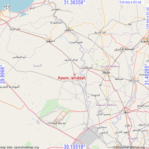
Kawm Ḩamādah GPS coordinates[2]
30° 45' 40.608" North, 30° 41' 58.992" East
| Map corner | latitude | longitude |
|---|---|---|
| Upper-left | 31.36358°, | 29.9966° |
| Center: | 30.76128°, | 30.69972° |
| Lower-right: | 30.15519°, | 31.40285° |
| Map W x H: | 134.4×134.4 km | = 83.5×83.5mi |
| max Lat: | 31.5084° ⇑30.4% North |
| Kawm Ḩamādah: | 30.76128° |
| min Lat: | ⇓69.6% South 22.3457° |
| min Long | Kawm Ḩamādah | max Long |
| 25.51965° | 30.69972° | 34.89572° |
| W 13%⇐ | ⇒87% E |
Elevation
Elevation of Kawm Ḩamādah is 15 m = 49 ft, and this is 28.5 m = 94 ft below average elevation for this country.
| Max E: |
1565 m = 5135 ft | 61.6% |
| Avg. | 43.5 m = 143 ft | |
| Kawm Ḩamādah | 15 m = 49 ft | |
Min E: |
-15 m = -49 ft | 38.4% |
See also: Egypt elevation on elevation.city.
Geographical zone
Kawm Ḩamādah is located in North temperate zone (between Tropic of Cancer and the Arctic Circle). Distance of this Northern Tropic circle is 814.4 km =506 mi to South.| Distance of | km | miles | from Kawm Ḩamādah |
|---|---|---|---|
| North Pole | 6586.7 | 4092.8 | to North |
| Arctic Circle | 3980.8 | 2473.6 | to North |
| Tropic Cancer | 814.4 | 506 | to South |
| Equator | 3420.3 | 2125.3 | to South |


Nearby cities:
15 places around Kawm Ḩamādah: (largest is in red/bold)
• Ad Dilinjāt
17.3 km =10.7 mi,  295°
295°
• Ash Shuhadā’
26.4 km =16.4 mi,  133°
133°
• Basyūn
22.6 km =14 mi,  28°
28°
• Beheira
43.7 km =27.2 mi,  231°
231°
• Damanhūr
37.5 km =23.3 mi,  323°
323°
• Disūq
41.6 km =25.8 mi,  353°
353°
• Kafr ash Shaykh
45.2 km =28.1 mi, 30°
• Kafr az Zayyāt
13.3 km =8.3 mi,  57°
57°
• Munshāt ‘Alī Āghā
44.1 km =27.4 mi,  0°
0°
• Munūf
39.7 km =24.7 mi,  145°
145°
• Quţūr
33.9 km =21.1 mi,  46°
46°
• Shibīn al Kawm
37.6 km =23.4 mi, 128°
• Talā
25 km =15.5 mi,  111°
111°
• Tanda
29 km =18 mi,  84°
84°
• Ḩawsh ‘Īsá
42.6 km =26.5 mi,  293°
293°
Sources, notices
• [Note1] Compared only with cities in Egypt existing in our database
• [Src1] Map data: © OpenStreetMap contributors (CC-BY-SA)
• [Src2] Other city data from geonames.org with taken over terms of usage.
• [Src3] Geographical zone / Annual Mean Temperature by Robert A. Rohde @ Wikipedia
