Bilbays geodata
Bilbays (Sharqia) is a populated place; located in Egypt in Africa/Cairo (GMT+2) time zone. With population of 129,211 people, there are 30 cities with bigger population in this country. Compared to other cities in Egypt, 55.1% of cities are located further ↓South; 61.6% of cities are located further ←West and 50.7% of cities have higher elevation than Bilbays. Note1


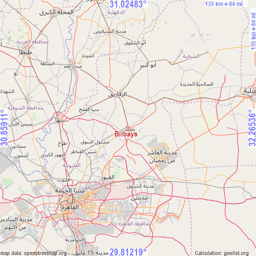
Bilbays GPS coordinates[2]
30° 25' 13.404" North, 31° 33' 44.028" East
| Map corner | latitude | longitude |
|---|---|---|
| Upper-left | 31.02483°, | 30.85911° |
| Center: | 30.42039°, | 31.56223° |
| Lower-right: | 29.81219°, | 32.26536° |
| Map W x H: | 134.8×134.8 km | = 83.8×83.8mi |
| max Lat: | 31.5084° ⇑44.9% North |
| Bilbays: | 30.42039° |
| min Lat: | ⇓55.1% South 22.3457° |
| min Long | Bilbays | max Long |
| 25.51965° | 31.56223° | 34.89572° |
| W 61.6%⇐ | ⇒38.4% E |
Elevation
Elevation of Bilbays is 17 m = 56 ft, and this is 26.5 m = 87 ft below average elevation for this country.
| Max E: |
1565 m = 5135 ft | 50.7% |
| Avg. | 43.5 m = 143 ft | |
| Bilbays | 17 m = 56 ft | |
Min E: |
-15 m = -49 ft | 49.3% |
See also: Bilbays elevation on elevation.city.
Geographical zone
Bilbays is located in North temperate zone (between Tropic of Cancer and the Arctic Circle). Distance of this Northern Tropic circle is 776.5 km =482.5 mi to South.| Distance of | km | miles | from Bilbays |
|---|---|---|---|
| North Pole | 6624.6 | 4116.3 | to North |
| Arctic Circle | 4018.7 | 2497.1 | to North |
| Tropic Cancer | 776.5 | 482.5 | to South |
| Equator | 3382.4 | 2101.7 | to South |


Nearby cities:
15 places around Bilbays: (largest is in red/bold)
• Abū Kabīr
35.5 km =22.1 mi,  17°
17°
• Al Ibrāhīmīyah
33.2 km =20.6 mi,  0°
0°
• Al Khānkah
29.9 km =18.6 mi,  218°
218°
• Al Qanāyāt
24.1 km =15 mi,  336°
336°
• Al Qurayn
27.4 km =17 mi,  37°
37°
• At Tall al Kabīr
25.3 km =15.7 mi,  57°
57°
• Banhā
36.5 km =22.7 mi,  276°
276°
• Diyarb Najm
38.9 km =24.2 mi, 342°
• Fāqūs
40.9 km =25.4 mi,  33°
33°
• Hihyā
28 km =17.4 mi,  5°
5°
• Kafr Şaqr
41.9 km =26 mi, 8°
• Mashtūl as Sūq
18.9 km =11.7 mi,  249°
249°
• Shibīn al Qanāṭir
26.1 km =16.2 mi,  242°
242°
• Toukh
35.4 km =22 mi,  258°
258°
• Zagazig
19.5 km =12.1 mi, 342°
Sources, notices
• [Note1] Compared only with cities in Egypt existing in our database
• [Src1] Map data: © OpenStreetMap contributors (CC-BY-SA)
• [Src2] Other city data from geonames.org with taken over terms of usage.
• [Src3] Geographical zone / Annual Mean Temperature by Robert A. Rohde @ Wikipedia
