Zagazig geodata
Zagazig (Sharqia) is a seat of a first-order administrative division; located in Egypt in Africa/Cairo (GMT+2) time zone. With population of 285,097 people, there are 11 cities with bigger population in this country. Compared to other cities in Egypt, 60.9% of cities are located further ↓South; 59.4% of cities are located further ←West and 55.1% of cities have higher elevation than Zagazig. Note1


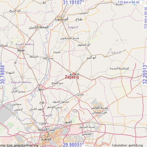
Zagazig GPS coordinates[2]
30° 35' 15.648" North, 31° 30' 7.2" East
| Map corner | latitude | longitude |
|---|---|---|
| Upper-left | 31.19107°, | 30.79888° |
| Center: | 30.58768°, | 31.502° |
| Lower-right: | 29.98051°, | 32.20513° |
| Map W x H: | 134.6×134.6 km | = 83.6×83.6mi |
| max Lat: | 31.5084° ⇑39.1% North |
| Zagazig: | 30.58768° |
| min Lat: | ⇓60.9% South 22.3457° |
| min Long | Zagazig | max Long |
| 25.51965° | 31.502° | 34.89572° |
| W 59.4%⇐ | ⇒40.6% E |
Elevation
Elevation of Zagazig is 16 m = 52 ft, and this is 27.5 m = 90 ft below average elevation for this country.
| Max E: |
1565 m = 5135 ft | 55.1% |
| Avg. | 43.5 m = 143 ft | |
| Zagazig | 16 m = 52 ft | |
Min E: |
-15 m = -49 ft | 44.9% |
See also: Zagazig elevation on elevation.city.
Geographical zone
Zagazig is located in North temperate zone (between Tropic of Cancer and the Arctic Circle). Distance of this Northern Tropic circle is 795.1 km =494.1 mi to South.| Distance of | km | miles | from Zagazig |
|---|---|---|---|
| North Pole | 6606 | 4104.8 | to North |
| Arctic Circle | 4000.1 | 2485.5 | to North |
| Tropic Cancer | 795.1 | 494.1 | to South |
| Equator | 3401 | 2113.3 | to South |


Nearby cities:
15 places around Zagazig: (largest is in red/bold)
• Abū Kabīr
22.3 km =13.9 mi,  46°
46°
• Al Ibrāhīmīyah
15.7 km =9.8 mi,  21°
21°
• Al Qanāyāt
5.2 km =3.2 mi,  312°
312°
• Al Qurayn
22.5 km =14 mi,  81°
81°
• At Tall al Kabīr
27.5 km =17.1 mi,  100°
100°
• Banhā
33.6 km =20.9 mi,  244°
244°
• Bilbays
19.5 km =12.1 mi,  162°
162°
• Diyarb Najm
19.5 km =12.1 mi,  342°
342°
• Fāqūs
32.2 km =20 mi,  61°
61°
• Hihyā
12.4 km =7.7 mi,  41°
41°
• Kafr Şaqr
25.7 km =16 mi,  27°
27°
• Mashtūl as Sūq
27.9 km =17.3 mi,  205°
205°
• Quwaysinā
33.1 km =20.6 mi,  265°
265°
• Shibīn al Qanāṭir
35.2 km =21.9 mi, 209°
• Zefta
28.4 km =17.6 mi,  299°
299°
Sources, notices
• [Note1] Compared only with cities in Egypt existing in our database
• [Src1] Map data: © OpenStreetMap contributors (CC-BY-SA)
• [Src2] Other city data from geonames.org with taken over terms of usage.
• [Src3] Geographical zone / Annual Mean Temperature by Robert A. Rohde @ Wikipedia
