Fuwwah geodata
Fuwwah (Kafr el-Sheikh) is a populated place; located in Egypt in Africa/Cairo (GMT+2) time zone. With population of 63,310 people, there are 63 cities with bigger population in this country. Compared to other cities in Egypt, 90.6% of cities are located further ↓South; 89.1% of cities are located further →East and 86.2% of cities have higher elevation than Fuwwah. Note1


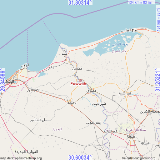
Fuwwah GPS coordinates[2]
31° 12' 13.14" North, 30° 32' 56.688" East
| Map corner | latitude | longitude |
|---|---|---|
| Upper-left | 31.80314°, | 29.84596° |
| Center: | 31.20365°, | 30.54908° |
| Lower-right: | 30.60034°, | 31.25221° |
| Map W x H: | 133.7×133.7 km | = 83.1×83.1mi |
| max Lat: | 31.5084° ⇑9.4% North |
| Fuwwah: | 31.20365° |
| min Lat: | ⇓90.6% South 22.3457° |
| min Long | Fuwwah | max Long |
| 25.51965° | 30.54908° | 34.89572° |
| W 10.9%⇐ | ⇒89.1% E |
Elevation
Elevation of Fuwwah is 9 m = 30 ft, and this is 34.5 m = 113 ft below average elevation for this country.
| Max E: |
1565 m = 5135 ft | 86.2% |
| Avg. | 43.5 m = 143 ft | |
| Fuwwah | 9 m = 30 ft | |
Min E: |
-15 m = -49 ft | 13.8% |
See also: Fuwwah elevation on elevation.city.
Geographical zone
Fuwwah is located in North temperate zone (between Tropic of Cancer and the Arctic Circle). Distance of this Northern Tropic circle is 863.6 km =536.6 mi to South.| Distance of | km | miles | from Fuwwah |
|---|---|---|---|
| North Pole | 6537.5 | 4062.2 | to North |
| Arctic Circle | 3931.7 | 2443 | to North |
| Tropic Cancer | 863.6 | 536.6 | to South |
| Equator | 3469.5 | 2155.8 | to South |


Nearby cities:
15 places around Fuwwah: (largest is in red/bold)
• Abū al Maţāmīr
48.4 km =30.1 mi,  227°
227°
• Ad Dilinjāt
41.8 km =26 mi,  181°
181°
• Basyūn
38.7 km =24 mi,  139°
139°
• Damanhūr
20.4 km =12.7 mi,  202°
202°
• Disūq
12.3 km =7.6 mi,  130°
130°
• Idkū
26.5 km =16.5 mi,  295°
295°
• Kafr ad Dawwār
40.6 km =25.2 mi,  258°
258°
• Kafr ash Shaykh
38.6 km =24 mi,  105°
105°
• Kafr az Zayyāt
49.3 km =30.6 mi,  148°
148°
• Kawm Ḩamādah
51.2 km =31.8 mi,  163°
163°
• Munshāt ‘Alī Āghā
15.4 km =9.6 mi, 109°
• Quţūr
46.5 km =28.9 mi,  123°
123°
• Rosetta
25.1 km =15.6 mi,  330°
330°
• Sīdī Sālim
23.8 km =14.8 mi,  71°
71°
• Ḩawsh ‘Īsá
40.7 km =25.3 mi,  217°
217°
Sources, notices
• [Note1] Compared only with cities in Egypt existing in our database
• [Src1] Map data: © OpenStreetMap contributors (CC-BY-SA)
• [Src2] Other city data from geonames.org with taken over terms of usage.
• [Src3] Geographical zone / Annual Mean Temperature by Robert A. Rohde @ Wikipedia
