Hihyā geodata
Hihyā (Sharqia) is a populated place; located in Egypt in Africa/Cairo (GMT+2) time zone. With population of 43,432 people, there are 97 cities with bigger population in this country. Compared to other cities in Egypt, 64.5% of cities are located further ↓South; 63% of cities are located further ←West and 65.2% of cities have higher elevation than Hihyā. Note1


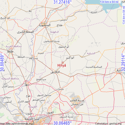
Hihyā GPS coordinates[2]
30° 40' 16.68" North, 31° 35' 16.836" East
| Map corner | latitude | longitude |
|---|---|---|
| Upper-left | 31.27416°, | 30.88489° |
| Center: | 30.6713°, | 31.58801° |
| Lower-right: | 30.06465°, | 32.29114° |
| Map W x H: | 134.5×134.5 km | = 83.6×83.6mi |
| max Lat: | 31.5084° ⇑35.5% North |
| Hihyā: | 30.6713° |
| min Lat: | ⇓64.5% South 22.3457° |
| min Long | Hihyā | max Long |
| 25.51965° | 31.58801° | 34.89572° |
| W 63%⇐ | ⇒37% E |
Elevation
Elevation of Hihyā is 14 m = 46 ft, and this is 29.5 m = 97 ft below average elevation for this country.
| Max E: |
1565 m = 5135 ft | 65.2% |
| Avg. | 43.5 m = 143 ft | |
| Hihyā | 14 m = 46 ft | |
Min E: |
-15 m = -49 ft | 34.8% |
See also: Hihyā elevation on elevation.city.
Geographical zone
Hihyā is located in North temperate zone (between Tropic of Cancer and the Arctic Circle). Distance of this Northern Tropic circle is 804.4 km =499.8 mi to South.| Distance of | km | miles | from Hihyā |
|---|---|---|---|
| North Pole | 6596.7 | 4099 | to North |
| Arctic Circle | 3990.8 | 2479.8 | to North |
| Tropic Cancer | 804.4 | 499.8 | to South |
| Equator | 3410.3 | 2119.1 | to South |


Nearby cities:
15 places around Hihyā: (largest is in red/bold)
• Abū Kabīr
10 km =6.2 mi,  53°
53°
• Ajā
41.4 km =25.7 mi,  316°
316°
• Al Ibrāhīmīyah
5.8 km =3.6 mi,  335°
335°
• Al Manşūrah
45.2 km =28.1 mi,  334°
334°
• Al Qanāyāt
13.4 km =8.3 mi,  244°
244°
• Al Qurayn
15.4 km =9.6 mi,  113°
113°
• At Tall al Kabīr
23.6 km =14.7 mi,  127°
127°
• Bilbays
28 km =17.4 mi,  185°
185°
• Diyarb Najm
16.9 km =10.5 mi,  303°
303°
• Fāqūs
21 km =13 mi,  72°
72°
• Kafr Şaqr
14 km =8.7 mi,  14°
14°
• Mashtūl as Sūq
40 km =24.9 mi,  210°
210°
• Quwaysinā
42.8 km =26.6 mi,  253°
253°
• Zagazig
12.4 km =7.7 mi,  221°
221°
• Zefta
33.2 km =20.6 mi,  278°
278°
Sources, notices
• [Note1] Compared only with cities in Egypt existing in our database
• [Src1] Map data: © OpenStreetMap contributors (CC-BY-SA)
• [Src2] Other city data from geonames.org with taken over terms of usage.
• [Src3] Geographical zone / Annual Mean Temperature by Robert A. Rohde @ Wikipedia
