Villarejo de Montalbán geodata
Villarejo de Montalbán (Castille-La Mancha) is a seat of a third-order administrative division; located in Spain in Europe/Madrid (GMT+2) time zone. With population of 76 people, there are 6179 cities with bigger population in this country. Compared to other cities in Spain, 73.3% of cities are located further ↑North; 67% of cities are located further →East and 59.5% of cities have higher elevation than Villarejo de Montalbán. Note1
Administrative division(s):
- Level 1: Castille-La Mancha
- Level 2: Province of Toledo
- Level 3: Villarejo de Montalbán
Current local time in Villarejo de Montalbán:
11:13 PM, ThursdayDifference from your time zone: hours


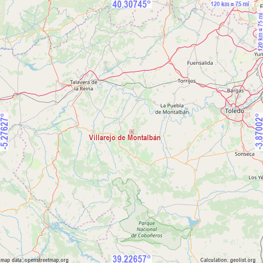
Villarejo de Montalbán GPS coordinates[2]
39° 46' 8.868" North, 4° 34' 23.304" West
| Map corner | latitude | longitude |
|---|---|---|
| Upper-left | 40.30745°, | -5.27627° |
| Center: | 39.76913°, | -4.57314° |
| Lower-right: | 39.22657°, | -3.87002° |
| Map W x H: | 120.2×120.2 km | = 74.7×74.7mi |
| max Lat: | 43.74134° ⇑73.3% North |
| Villarejo de Montalbán: | 39.76913° |
| min Lat: | ⇓26.7% South 27.64134° |
| min Long | Villarejo de Mo | max Long |
| -18.00367° | -4.57314° | 4.2899° |
| W 33%⇐ | ⇒67% E |
Elevation
Elevation of Villarejo de Montalbán is 534 m = 1752 ft, and this is 64 m = 210 ft below average elevation for this country.
| Max E: |
1682 m = 5518 ft | 59.5% |
| Avg. | 598 m = 1962 ft | |
| Villarejo de Montalbán | 534 m = 1752 ft | |
Min E: |
0 m = 0 ft | 40.5% |
See also: Spain elevation on elevation.city.
Geographical zone
Villarejo de Montalbán is located in North temperate zone (between Tropic of Cancer and the Arctic Circle). Distance of this Northern Tropic circle is 1816 km =1128.4 mi to South.| Distance of | km | miles | from Villarejo de Montalbán |
|---|---|---|---|
| North Pole | 5585.1 | 3470.4 | to North |
| Arctic Circle | 2979.3 | 1851.3 | to North |
| Tropic Cancer | 1816 | 1128.4 | to South |
| Equator | 4421.9 | 2747.6 | to South |


Nearby cities:
15 places around Villarejo de Montalbán: (largest is in red/bold)
• Cebolla
20 km =12.4 mi,  0°
0°
• El Carpio de Tajo
16.7 km =10.4 mi,  37°
37°
• Erustes
21.9 km =13.6 mi,  17°
17°
• Hontanar
18.6 km =11.6 mi,  159°
159°
• La Puebla de Montalbán
21 km =13 mi,  60°
60°
• La Pueblanueva
18.3 km =11.4 mi,  330°
330°
• Los Navalmorales
7.7 km =4.8 mi,  230°
230°
• Los Navalucillos
12.8 km =8 mi,  207°
207°
• Malpica
14.4 km =8.9 mi,  7°
7°
• Navahermosa
17.3 km =10.7 mi,  149°
149°
• San Bartolomé de las Abiertas
14.2 km =8.8 mi,  298°
298°
• San Martín de Montalbán
17.5 km =10.9 mi,  115°
115°
• San Martín de Pusa
5.3 km =3.3 mi,  288°
288°
• Santa Ana de Pusa
11.6 km =7.2 mi,  266°
266°
• Torrecilla de la Jara
18.5 km =11.5 mi,  246°
246°
Sources, notices
• [Note1] Compared only with cities in Spain existing in our database
• [Src1] Map data: © OpenStreetMap contributors (CC-BY-SA)
• [Src2] Other city data from geonames.org with taken over terms of usage.
• [Src3] Geographical zone / Annual Mean Temperature by Robert A. Rohde @ Wikipedia
