San Martín de Montalbán geodata
San Martín de Montalbán (Castille-La Mancha) is a seat of a third-order administrative division; located in Spain in Europe/Madrid (GMT+2) time zone. With population of 745 people, there are 3316 cities with bigger population in this country. Compared to other cities in Spain, 74.4% of cities are located further ↑North; 64.8% of cities are located further →East and 50.1% of cities have higher elevation than San Martín de Montalbán. Note1
Administrative division(s):
- Level 1: Castille-La Mancha
- Level 2: Province of Toledo
- Level 3: San Martín de Montalbán
Current local time in San Martín de Montalbán:
10:50 PM, ThursdayDifference from your time zone: hours


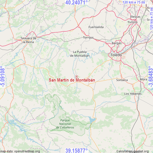
San Martín de Montalbán GPS coordinates[2]
39° 42' 6.696" North, 4° 23' 16.656" West
| Map corner | latitude | longitude |
|---|---|---|
| Upper-left | 40.24071°, | -5.09108° |
| Center: | 39.70186°, | -4.38796° |
| Lower-right: | 39.15877°, | -3.68483° |
| Map W x H: | 120.3×120.3 km | = 74.8×74.8mi |
| max Lat: | 43.74134° ⇑74.4% North |
| San Martín de Montalbán: | 39.70186° |
| min Lat: | ⇓25.6% South 27.64134° |
| min Long | San Martín de | max Long |
| -18.00367° | -4.38796° | 4.2899° |
| W 35.2%⇐ | ⇒64.8% E |
Elevation
Elevation of San Martín de Montalbán is 656 m = 2152 ft, and this is 58 m = 190 ft above average elevation for this country.
| Max E: |
1682 m = 5518 ft | 50.1% |
| San Martín de Montalbán | 656 m 2152 ft | |
| Avg. | 598 m = 1962 ft | |
Min E: |
0 m = 0 ft | 49.9% |
See also: Spain elevation on elevation.city.
Geographical zone
San Martín de Montalbán is located in North temperate zone (between Tropic of Cancer and the Arctic Circle). Distance of this Northern Tropic circle is 1808.5 km =1123.7 mi to South.| Distance of | km | miles | from San Martín de Montalbán |
|---|---|---|---|
| North Pole | 5592.6 | 3475.1 | to North |
| Arctic Circle | 2986.7 | 1855.8 | to North |
| Tropic Cancer | 1808.5 | 1123.7 | to South |
| Equator | 4414.4 | 2743 | to South |


Nearby cities:
15 places around San Martín de Montalbán: (largest is in red/bold)
• Cuerva
15.7 km =9.8 mi,  105°
105°
• El Carpio de Tajo
21.4 km =13.3 mi,  344°
344°
• Gálvez
9.9 km =6.2 mi,  89°
89°
• Hontanar
13.6 km =8.5 mi,  223°
223°
• La Puebla de Montalbán
18.1 km =11.2 mi,  7°
7°
• Los Navalmorales
21.9 km =13.6 mi,  276°
276°
• Los Navalucillos
22.1 km =13.7 mi,  259°
259°
• Menasalbas
11.3 km =7 mi,  127°
127°
• Navahermosa
10.2 km =6.3 mi, 223°
• Noez
18 km =11.2 mi,  76°
76°
• Polán
21.1 km =13.1 mi,  63°
63°
• Pulgar
20.2 km =12.6 mi, 92°
• Totanés
13.8 km =8.6 mi, 85°
• Ventas con Peña Aguilera
16.8 km =10.4 mi, 127°
• Villarejo de Montalbán
17.5 km =10.9 mi,  295°
295°
Sources, notices
• [Note1] Compared only with cities in Spain existing in our database
• [Src1] Map data: © OpenStreetMap contributors (CC-BY-SA)
• [Src2] Other city data from geonames.org with taken over terms of usage.
• [Src3] Geographical zone / Annual Mean Temperature by Robert A. Rohde @ Wikipedia
