Navahermosa geodata
Navahermosa (Castille-La Mancha) is a seat of a third-order administrative division; located in Spain in Europe/Madrid (GMT+2) time zone. With population of 4,146 people, there are 1443 cities with bigger population in this country. Compared to other cities in Spain, 75.3% of cities are located further ↑North; 65.7% of cities are located further →East and 58.9% of cities have lower elevation than Navahermosa. Note1
Administrative division(s):
- Level 1: Castille-La Mancha
- Level 2: Province of Toledo
- Level 3: Navahermosa


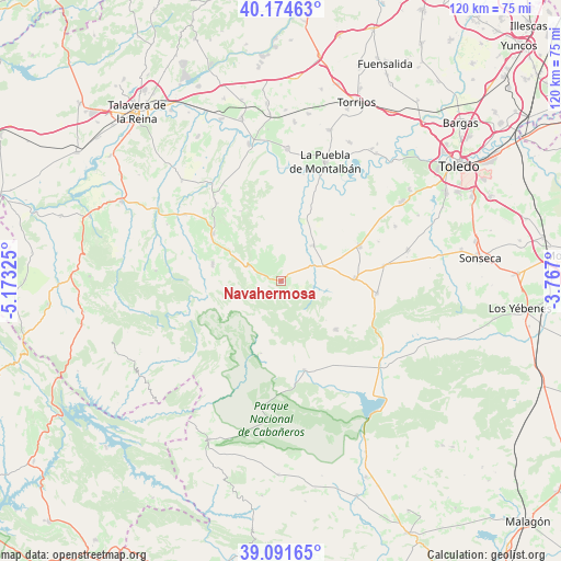
Navahermosa GPS coordinates[2]
39° 38' 6.936" North, 4° 28' 12.432" West
| Map corner | latitude | longitude |
|---|---|---|
| Upper-left | 40.17463°, | -5.17325° |
| Center: | 39.63526°, | -4.47012° |
| Lower-right: | 39.09165°, | -3.767° |
| Map W x H: | 120.4×120.4 km | = 74.8×74.8mi |
| max Lat: | 43.74134° ⇑75.3% North |
| Navahermosa: | 39.63526° |
| min Lat: | ⇓24.7% South 27.64134° |
| min Long | Navahermosa | max Long |
| -18.00367° | -4.47012° | 4.2899° |
| W 34.3%⇐ | ⇒65.7% E |
Elevation
Elevation of Navahermosa is 736 m = 2415 ft, and this is 138 m = 453 ft above average elevation for this country.
| Max E: |
1682 m = 5518 ft | 41.1% |
| Navahermosa | 736 m 2415 ft | |
| Avg. | 598 m = 1962 ft | |
Min E: |
0 m = 0 ft | 58.9% |
See also: Spain elevation on elevation.city.
Geographical zone
Navahermosa is located in North temperate zone (between Tropic of Cancer and the Arctic Circle). Distance of this Northern Tropic circle is 1801.1 km =1119.2 mi to South.| Distance of | km | miles | from Navahermosa |
|---|---|---|---|
| North Pole | 5600 | 3479.7 | to North |
| Arctic Circle | 2994.1 | 1860.4 | to North |
| Tropic Cancer | 1801.1 | 1119.2 | to South |
| Equator | 4407 | 2738.4 | to South |


Nearby cities:
15 places around Navahermosa: (largest is in red/bold)
• Cuerva
22.4 km =13.9 mi,  81°
81°
• Espinoso del Rey
26.9 km =16.7 mi,  274°
274°
• Gálvez
18.5 km =11.5 mi,  66°
66°
• Hontanar
3.4 km =2.1 mi,  222°
222°
• Los Navalmorales
17.8 km =11.1 mi,  304°
304°
• Los Navalucillos
15.1 km =9.4 mi,  283°
283°
• Menasalbas
15.9 km =9.9 mi,  88°
88°
• Navas de Estena
16.2 km =10.1 mi,  195°
195°
• Retuerta de Bullaque
19.7 km =12.2 mi,  165°
165°
• San Martín de Montalbán
10.2 km =6.3 mi,  43°
43°
• San Martín de Pusa
21.6 km =13.4 mi,  319°
319°
• Santa Ana de Pusa
24.9 km =15.5 mi, 304°
• Totanés
22.5 km =14 mi, 68°
• Ventas con Peña Aguilera
20.6 km =12.8 mi,  97°
97°
• Villarejo de Montalbán
17.3 km =10.7 mi,  329°
329°
Sources, notices
• [Note1] Compared only with cities in Spain existing in our database
• [Src1] Map data: © OpenStreetMap contributors (CC-BY-SA)
• [Src2] Other city data from geonames.org with taken over terms of usage.
• [Src3] Geographical zone / Annual Mean Temperature by Robert A. Rohde @ Wikipedia
