Malpica geodata
Malpica (Castille-La Mancha) is a populated place; located in Spain in Europe/Madrid (GMT+2) time zone. With population of 1,971 people, there are 2195 cities with bigger population in this country. Compared to other cities in Spain, 71.7% of cities are located further ↑North; 66.8% of cities are located further →East and 69% of cities have higher elevation than Malpica. Note1
Administrative division(s):
- Level 1: Castille-La Mancha
- Level 2: Province of Toledo
- Level 3: Carpio de Tajo, El


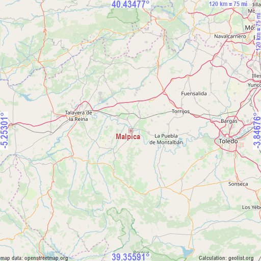
Malpica GPS coordinates[2]
39° 53' 50.856" North, 4° 32' 59.568" West
| Map corner | latitude | longitude |
|---|---|---|
| Upper-left | 40.43477°, | -5.25301° |
| Center: | 39.89746°, | -4.54988° |
| Lower-right: | 39.35591°, | -3.84676° |
| Map W x H: | 120×120 km | = 74.6×74.6mi |
| max Lat: | 43.74134° ⇑71.7% North |
| Malpica: | 39.89746° |
| min Lat: | ⇓28.3% South 27.64134° |
| min Long | Malpica | max Long |
| -18.00367° | -4.54988° | 4.2899° |
| W 33.2%⇐ | ⇒66.8% E |
Elevation
Elevation of Malpica is 398 m = 1306 ft, and this is 200 m = 656 ft below average elevation for this country.
| Max E: |
1682 m = 5518 ft | 69% |
| Avg. | 598 m = 1962 ft | |
| Malpica | 398 m = 1306 ft | |
Min E: |
0 m = 0 ft | 31% |
See also: Spain elevation on elevation.city.
Geographical zone
Malpica is located in North temperate zone (between Tropic of Cancer and the Arctic Circle). Distance of this Northern Tropic circle is 1830.3 km =1137.3 mi to South.| Distance of | km | miles | from Malpica |
|---|---|---|---|
| North Pole | 5570.9 | 3461.6 | to North |
| Arctic Circle | 2965 | 1842.4 | to North |
| Tropic Cancer | 1830.3 | 1137.3 | to South |
| Equator | 4436.2 | 2756.5 | to South |


Nearby cities:
15 places around Malpica: (largest is in red/bold)
• Carmena
14.2 km =8.8 mi,  62°
62°
• Carriches
10.7 km =6.6 mi,  46°
46°
• Cebolla
6 km =3.7 mi,  341°
341°
• Domingo Pérez
9.6 km =6 mi,  23°
23°
• El Carpio de Tajo
8.3 km =5.2 mi,  97°
97°
• Erustes
8 km =5 mi,  34°
34°
• Illán de Vacas
8.2 km =5.1 mi,  355°
355°
• La Mata
10.7 km =6.6 mi, 62°
• La Pueblanueva
11.2 km =7 mi,  278°
278°
• Lucillos
11.1 km =6.9 mi,  331°
331°
• Montearagón
10.2 km =6.3 mi,  316°
316°
• Otero
11.9 km =7.4 mi,  14°
14°
• San Bartolomé de las Abiertas
16.3 km =10.1 mi,  242°
242°
• San Martín de Pusa
14.5 km =9 mi,  209°
209°
• Villarejo de Montalbán
14.4 km =8.9 mi,  187°
187°
Sources, notices
• [Note1] Compared only with cities in Spain existing in our database
• [Src1] Map data: © OpenStreetMap contributors (CC-BY-SA)
• [Src2] Other city data from geonames.org with taken over terms of usage.
• [Src3] Geographical zone / Annual Mean Temperature by Robert A. Rohde @ Wikipedia
